Category:1770s maps of Connecticut
States of the United States: Alabama · Alaska · California · Connecticut · Delaware · Florida · Georgia · Illinois · Indiana · Kentucky · Louisiana · Maine · Maryland · Massachusetts · Mississippi · Missouri · New Hampshire · New Jersey · New York · North Carolina · Ohio · Pennsylvania · Rhode Island · South Carolina · Tennessee · Vermont · Virginia
Puerto Rico
Puerto Rico
Subcategories
This category has the following 2 subcategories, out of 2 total.
- 1777 maps of Connecticut (2 F)
- 1778 maps of Connecticut (1 F)
Media in category "1770s maps of Connecticut"
The following 4 files are in this category, out of 4 total.
-
-

-
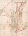
 A map of Connecticut and Rhode Island with Long Island Sound, etc. LOC 99466764.jpg 2,790 × 2,368; 1.36 MB
-
 Map of the English invasion of New Haven Connecticut July 1779.jpg 465 × 750; 35 KB


