Category:1770s maps of Rhode Island
States of the United States: Alabama · Alaska · California · Connecticut · Delaware · Florida · Georgia · Illinois · Indiana · Kentucky · Louisiana · Maine · Maryland · Massachusetts · Mississippi · Missouri · New Hampshire · New Jersey · New York · North Carolina · Ohio · Pennsylvania · Rhode Island · South Carolina · Tennessee · Vermont · Virginia
Puerto Rico
Puerto Rico
Media in category "1770s maps of Rhode Island"
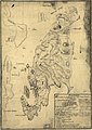
The following 16 files are in this category, out of 16 total.
-
 1776 map Newport RhodeIsland byDesBarres BPL 12640.png 474 × 661; 320 KB
-
 1778 Rhode Island detail of map byKitchin BPL 14154.png 1,055 × 743; 1.56 MB
-
 A chart of the harbour of Rhode Island and Narraganset Bay (3045761151).jpg 1,381 × 2,000; 2.44 MB
-
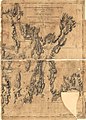 A chart of the harbour of Rhode Island and Narraganset Bay. LOC 76695361.jpg 7,610 × 10,593; 15.3 MB
-
 A chart of the harbour of Rhode Island and Narraganset Bay. LOC 76695361.tif 7,610 × 10,593; 230.64 MB
-
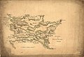
 A map of Connecticut and Rhode Island with Long Island Sound, etc. LOC 99466764.jpg 2,790 × 2,368; 1.36 MB
-

-
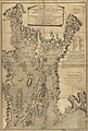
 A plan of the town of Newport in Rhode Island. LOC 74692104.jpg 4,685 × 4,390; 4.08 MB
-
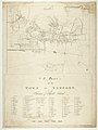 A plan of the town of Newport in the province of Rhode Island RMG K0282.jpg 958 × 1,280; 906 KB
-
-
 Attacks upon Rhode Island, Augt. 1778. LOC gm71000685.jpg 6,299 × 4,304; 3.25 MB
-

-

-
 Plan of the town and harbour of Newport on Rhode Island RMG F0389.tiff 6,164 × 5,821; 102.66 MB
-
-
 Vie de George Washington 1807 (125491537).jpg 4,835 × 7,664; 7.96 MB


.jpg)


.jpg)


.jpg)