Category:18th-century maps of Rhode Island
States of the United States: Alabama · Alaska · Arizona · Arkansas · California · Colorado · Connecticut · Delaware · Florida · Georgia · Hawaii · Illinois · Indiana · Kansas · Kentucky · Louisiana · Maine · Maryland · Massachusetts · Michigan · Minnesota · Mississippi · Missouri · Montana · Nevada · New Hampshire · New Jersey · New Mexico · New York · North Carolina · North Dakota · Ohio · Oklahoma · Oregon · Pennsylvania · Rhode Island · South Carolina · Tennessee · Texas · Utah · Vermont · Virginia · Washington · West Virginia · Wisconsin – Washington, D.C.
Puerto Rico
Puerto Rico
Subcategories
This category has the following 5 subcategories, out of 5 total.
- 1750s maps of Rhode Island (1 F)
- 1780s maps of Rhode Island (2 F)
Media in category "18th-century maps of Rhode Island"
The following 7 files are in this category, out of 7 total.
-
-
-

-

-
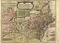
 Les principales forteresses, ports &c. de lAmérique septentrionale (4071869633).jpg 8,936 × 7,408; 10.23 MB
-
 Mitchell Map-excerpt01.jpg 2,400 × 1,864; 1.34 MB
-
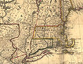
 New England, New York, New Jersey, and Pensilvania etc NYPL435000.tiff 4,662 × 4,976; 66.38 MB

.jpg)

.jpg)
