Category:18th-century maps of California
States of the United States: Alabama · Alaska · Arizona · Arkansas · California · Colorado · Connecticut · Delaware · Florida · Georgia · Hawaii · Illinois · Indiana · Kansas · Kentucky · Louisiana · Maine · Maryland · Massachusetts · Michigan · Minnesota · Mississippi · Missouri · Montana · Nevada · New Hampshire · New Jersey · New Mexico · New York · North Carolina · North Dakota · Ohio · Oklahoma · Oregon · Pennsylvania · Rhode Island · South Carolina · Tennessee · Texas · Utah · Vermont · Virginia · Washington · West Virginia · Wisconsin – Washington, D.C.
Puerto Rico
Puerto Rico
| NO WIKIDATA ID FOUND! Search for 18th-century maps of California on Wikidata | |
| Upload media |

Subcategories
This category has the following 5 subcategories, out of 5 total.
- 1750s maps of California (4 F)
- 1760s maps of California (1 F)
Media in category "18th-century maps of California"
The following 10 files are in this category, out of 10 total.
-
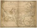 1721 Map of the new part of French Louisiana.jpg 8,104 × 6,291; 14.19 MB
-
-

-

-
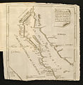
 1781 Diseño del Pueblo de San José, California.jpg 600 × 834; 202 KB
-

-
 Carte de la Californie et des pays nord-ouest (MAPS 96).jpg 7,058 × 5,955; 9.75 MB
-

-
 Karta Kalifornije i Baje Californije,Ferdinand Konščak.jpg 470 × 481; 120 KB
-
 Voyage de La Pérouse autour du monde (No. 16) BHL15849654.jpg 6,832 × 9,696; 3.69 MB


.jpg)


_BHL15849654.jpg)