Category:1793 maps
| ← · 1790 · 1791 · 1792 · 1793 · 1794 · 1795 · 1796 · 1797 · 1798 · 1799 · → |
Deutsch: Karten mit Bezug zum Jahr 1793
English: Maps related to the year 1793
Español: Mapas relativos al año 1793
Français : Cartes concernant l’an 1793
Русский: Карты 1793 года
Subcategories
This category has the following 6 subcategories, out of 6 total.
Media in category "1793 maps"
The following 55 files are in this category, out of 55 total.
-
 13e chasseurs à cheval 1793.png 1,024 × 1,462; 597 KB
-
-

-
 Alexander Anderson, Jerusalem (FL184620846 2367984).jpg 4,384 × 3,528; 17.97 MB
-
 AMH-5358-NA Map of the island of Waipin.jpg 2,400 × 1,451; 365 KB
-

-
 Anse de Gijon RMG K1052.jpg 1,280 × 922; 829 KB
-
 Baie de Palme (and six other plans in the Balearics) RMG K1060.jpg 931 × 1,280; 944 KB
-
 Carta esférica de la canal entre Puerto Rico y Santo Domingo LOC 90683910.jpg 9,723 × 6,762; 5.51 MB
-
 Carta esférica de la canal entre Puerto Rico y Santo Domingo LOC 90683910.tif 9,723 × 6,762; 188.1 MB
-
 Carta esférica de la Ysla de la Granada LOC 90683958.jpg 12,124 × 7,839; 8.19 MB
-
 Carta esférica de la Ysla de la Granada LOC 90683958.tif 12,124 × 7,839; 271.91 MB
-
 Carta esférica de la Ysla de Tabago LOC 90680622.jpg 11,581 × 7,659; 6.7 MB
-
 Carta esférica de la Ysla de Tabago LOC 90680622.tif 11,581 × 7,659; 253.77 MB
-
 Carta esférica de las Yslas Virgenes LOC 90680623.jpg 10,157 × 6,928; 6.08 MB
-
 Carta esférica de las Yslas Virgenes LOC 90680623.tif 10,157 × 6,928; 201.32 MB
-
 Carta esférica de las Yslas Virgenes LOC 90680626.jpg 9,552 × 6,928; 6.1 MB
-
 Carta esférica de las Yslas Virgenes LOC 90680626.tif 9,552 × 6,928; 189.33 MB
-
 Carta esférica del Golfo de Panama LOC 90680560.jpg 11,669 × 7,661; 6.97 MB
-

-

-

-

-

-
 Der Südlicher Theil von Untersteyermark oder der Cillier Kreis 1793.jpg 8,596 × 7,160; 12.98 MB
-
 Divisions of France Proposed by William Playfair in 1793.jpg 1,280 × 1,412; 204 KB
-

-
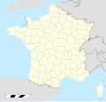 France location map-Departements 1793.svg 2,000 × 1,922; 565 KB
-
 Fürstentum Hohenlohe - Reilly 1793 - cropped.png 2,821 × 2,117; 8.93 MB
-
 Fürstentum Hohenlohe - Reilly 1793.png 4,195 × 3,083; 20.68 MB
-
 Galapagos Arrowsmith.jpg 2,913 × 3,929; 4.18 MB
-
 Gulf of Burgas, Black Sea RMG K0974.jpg 1,280 × 1,202; 934 KB
-

-

-
 Map of Anhalt 1793 ru.jpg 1,194 × 695; 169 KB
-
 Map of Asia Minor, 1793 (Trusler).jpg 2,272 × 2,192; 1,020 KB
-
 Nación Chiriguana.jpg 724 × 960; 210 KB
-

-

-
-

-

-
 Plan of the harbour, fort, town and environs of Fort Royal in Martinique RMG K0893.jpg 1,028 × 1,280; 1,019 KB
-
 Plan of the town of Stratham LOC 97683083.jpg 2,516 × 3,159; 1.54 MB
-
 Plan of the town of Stratham LOC 97683083.tif 2,516 × 3,159; 22.74 MB
-

-

-

-

-

-

-
 Reilly 208.jpg 1,314 × 969; 658 KB
-
 River Tranche RMG K1023.jpg 1,280 × 453; 362 KB
-
 Testigo Grande 1793 map.jpg 6,952 × 4,435; 3.41 MB
-


.jpg)


_RMG_K1060.jpg)


,_RP-P-OB-86.233.jpg)

.jpg)

.jpg)

_containing_in_the_whole_59,000_acres_-_situate_on_different_waters_of_south_Edisto_River,_except_seven_tracts_(or_7000_acres)_are_lying_on_the_LOC_2007630447.jpg)


.jpg)