Category:17th-century maps of Sri Lanka
Countries of Asia: Afghanistan · Armenia‡ · Azerbaijan‡ · Cambodia · People's Republic of China · Cyprus‡ · Egypt‡ · Georgia‡ · India · Indonesia‡ · Iran · Iraq · Japan · Jordan · Lebanon · Mongolia · Oman · Pakistan · Philippines · Russia‡ · Singapore · Sri Lanka · Syria · Thailand · Turkey‡ · Vietnam · Yemen
Limited recognition: Abkhazia‡ · Taiwan · State of Palestine
‡: partly located in Asia
Limited recognition: Abkhazia‡ · Taiwan · State of Palestine
‡: partly located in Asia
Subcategories
This category has the following 3 subcategories, out of 3 total.
Media in category "17th-century maps of Sri Lanka"
The following 26 files are in this category, out of 26 total.
-

-
 Regnum Jafnapatnam cum insulis adjacentibus RMG F0044.jpg 1,280 × 1,021; 1.41 MB
-
 Jaffna.gif 469 × 388; 17 KB
-
 Sjökort-Sjökort över Ceylon. Runt kartusch i nedre högra hörnet syns flera människor - Sjöhistoriska museet - 2007-006-43.tif 4,724 × 3,307, 2 pages; 23.63 MB
-
 Robert-knox new-map-of-ceylon.jpg 800 × 610; 136 KB
-
 RobertKnox1681mapCeylonTamilcountrynortheast.jpeg 700 × 528; 108 KB
-

-
 Map - Special Collections University of Amsterdam - OTM- HB-KZL 33.13.45.tif 7,424 × 6,321; 134.26 MB
-
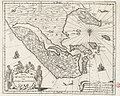
 Map of ancient Ceylon, 1683.jpg 725 × 1,077; 153 KB
-
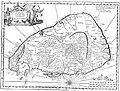
 Map of Ceylon, 1683.jpg 725 × 1,077; 181 KB
-

-
 Atlante Veneto Volume 2 108.jpg 10,575 × 7,116; 7.47 MB
-
 Map-of-ceylon-c1692.jpg 1,600 × 1,220; 521 KB
-
 MapofEelamTamilcountryengraving1692.jpg 1,600 × 1,220; 805 KB
-
 Colombo Dessave.jpg 4,876 × 4,005; 2.26 MB
-
 Commandement Galle.jpg 5,094 × 4,074; 2.59 MB
-
 Mature, KITLV 500068.jpg 8,096 × 3,728; 1.28 MB
-
 Madurai, Mission map (1737 detail2).jpg 531 × 559; 144 KB
-
 AMH-2616-NA The foremost cities of the beseiged Colombo in 1656.jpg 2,400 × 1,683; 605 KB
-
 AMH-4491-NA Bird's eye view of the city of Jaffnapatnam.jpg 2,400 × 1,669; 562 KB
-
 Insula Zeilan olim Taprobana nunc incolis Tenarisim - CBT 6625125.jpg 5,831 × 4,703; 6.8 MB
-
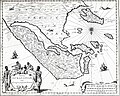 Jaffna kingdom 1619.jpg 758 × 606; 432 KB
-
 Mao Kun map - Ceylon, Africa.png 497 × 665; 332 KB
-
 RobMordenmapTamilcountryVanni.jpg 300 × 386; 34 KB
-
 UBBasel Map Malediven Sri Lanka 1652 Kartenslg Mappe 251-72.tif 6,203 × 3,675, 2 pages; 65.24 MB
-
 UBBasel Map Malediven Sri Lanka 1679 Kartenslg Mappe 251-73.tif 6,082 × 3,582, 2 pages; 62.35 MB
.jpg)


.jpg)


_-_Geographicus_-_Taprobane-mallet-1686.jpg)


.jpg)


