Category:17th-century maps of the Ottoman Empire
Habsburg Monarchy · Holy Roman Empire · Ottoman Empire · Prussia · Tsardom of Russia · Spanish Empire ·
English: This category is about history maps on the subject. Old maps belong into: Category:17th-century maps of the Ottoman Empire and its subcategories.
Subcategories
This category has the following 26 subcategories, out of 26 total.
Media in category "17th-century maps of the Ottoman Empire"
The following 10 files are in this category, out of 10 total.
-
-

-

-
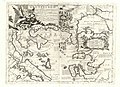
 Estats de l'empire dv Grand Seignevr.jpg 1,793 × 1,304; 670 KB
-
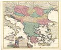
 Kaart van het Turkse Rijk Tvrcicvm imperivm (titel op object), NG-501-63.jpg 5,370 × 4,596; 3.94 MB
-
 Map - Special Collections University of Amsterdam - OTM- HB-KZL 33.05.23.tif 7,136 × 6,121; 124.97 MB
-
 Map - Special Collections University of Amsterdam - OTM- HB-KZL 33.05.34.tif 7,340 × 6,250; 131.25 MB
-
 Map - Special Collections University of Amsterdam - OTM- HB-KZL 33.06.20.tif 7,552 × 6,254; 135.13 MB
-
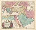
 Map The decadence of the Ottoman Empire- Touring Club Italiano CART-TRC-45 02.jpg 4,874 × 3,102; 1.82 MB
-
 Travels of Pietro della Valle-4.png 1,591 × 1,125; 672 KB

.jpg)
.jpg)

,_NG-501-63.jpg)

