Category:1800s maps of Japan
Subcategories
This category has the following 3 subcategories, out of 3 total.
- 1804 maps of Japan (3 F)
- 1808 maps of Japan (1 F)
Media in category "1800s maps of Japan"
The following 12 files are in this category, out of 12 total.
-
 Illustrated general route map of three countries (14590511136).jpg 2,500 × 1,764; 1.2 MB
-
 Map of Japan (14330134144).jpg 2,500 × 1,649; 1.36 MB
-
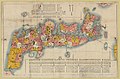
 Pilgrim's map of Kantō district (14610306171).jpg 2,500 × 1,961; 2.25 MB
-
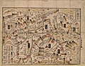
 Map of the entire Shimotsuke Province (15206523570).jpg 2,500 × 1,816; 2.23 MB
-
 Meditation Map of Mt. Fuji.jpg 8,999 × 6,110; 10.89 MB
-
 Zhi li ge sheng yu di quan tu - Zhang Zongjing - btv1b53103898v (17 of 69).jpg 5,102 × 4,405; 2.65 MB
-
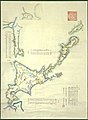 Ezo&karafuto.jpg 800 × 1,090; 92 KB
-
 General'naya karta Yaponskago Gosudarstva.jpg 14,682 × 10,309; 13.28 MB
-
 1809 Pinkerton Map of Korea ^ Japan - Geographicus - JapanKorea-pinkerton-1809.jpg 3,000 × 2,329; 1.54 MB
-
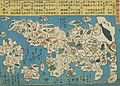
 KaiIchiranzu1806.jpg 697 × 844; 603 KB
-
 Kuni rebus 2.jpg 3,497 × 2,492; 2.25 MB
-
 Atlas moderne portatif 1804 (84188695).jpg 6,334 × 5,265; 4.32 MB
.jpg)
.jpg)
.jpg)

.jpg)


.jpg)
.jpg)