Category:1850s maps of Japan
Subcategories
This category has the following 7 subcategories, out of 7 total.
- 1853 maps of Japan (1 F)
- 1855 maps of Japan (11 F)
Media in category "1850s maps of Japan"
The following 21 files are in this category, out of 21 total.
-
 Detailed itinerary map of great Japan.jpg 2,500 × 469; 747 KB
-
 General land map of Sagami Province (14558465877).jpg 2,500 × 1,965; 1.9 MB
-
 Izumoji bunjiro, mappa completa del grande giappone, 1852.jpg 3,088 × 1,748; 3.89 MB
-
 The Eastern Japan map of Haiguotuzhi.jpg 1,783 × 1,333; 300 KB
-
 The Western Japan map of Haiguotuzhi.jpg 1,824 × 1,315; 262 KB
-
-
 Sketch Map of the City and Villages of Edo, Ansei Revised Edition.jpg 8,999 × 8,571; 16.67 MB
-
 Dochu Mitte.jpg 6,748 × 1,484; 4.5 MB
-
 Nagakubo Asia Syotoyo map.jpg 500 × 449; 77 KB
-

-
 Admiralty Chart No 2347 Japan Nipon Kiusiu and Sikok and part of Korea, published 1855.jpg 10,000 × 8,098; 7.85 MB
-
 Chassiron 1858 carte japon.jpg 763 × 1,200; 271 KB
-
 Dochu Mitte 2.jpg 6,748 × 1,013; 3.09 MB
-
 Evariste Huc carte voyage.jpg 3,559 × 2,794; 2.1 MB
-
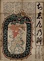 Jishinnoben1855.jpg 2,967 × 4,048; 3.58 MB
-
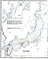 Map of Japan 1855.jpg 1,872 × 2,310; 599 KB
-
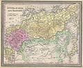
 MapJTallisAtlasJapanCorea.jpg 700 × 529; 66 KB
-

-
 Oedo Bancho Kiriezu.jpg 3,988 × 3,582; 9.31 MB
-
 Zyutei bankoku zenzu 1855.jpg 466 × 466; 135 KB
-
 離湖1800年代.jpg 3,648 × 2,736; 3.72 MB
.jpg)


_(14781453801).jpg)


