Category:1850s maps of Egypt
Media in category "1850s maps of Egypt"
The following 44 files are in this category, out of 44 total.
-

-

-
 Atlas turc - F. de Brocktorff, del - btv1b84432795 (06 of 11).jpg 4,991 × 7,702; 4.09 MB
-
 Lepsius-Projekt tw 1-1-02.jpg 1,567 × 1,968; 507 KB
-
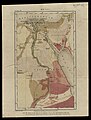
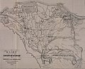
 (1852) ROUTE FROM CAIRO TO KORDOFAN.jpg 1,209 × 2,193; 713 KB
-

-

-
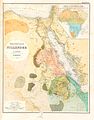
 HEINZELMANN(1854) 12.993 Kartenblatt Arabien, Nilländer Afrikas.jpg 3,871 × 3,765; 6.96 MB
-
-
 TOBIN(1855) p128 ROUTE ON THE NILE.jpg 2,726 × 3,735; 4.45 MB
-
 1856 Kiepert Map of the Sinai Peninsula, Egypt - Geographicus - Sinai-kiepert-1856.jpg 3,500 × 4,449; 4.12 MB
-
 Arthur Penrhyn Stanley, Egypt (FL25553432 2367108).jpg 5,022 × 6,807; 42.87 MB
-
 Arthur Penrhyn Stanley, Egypt (FL25553402 2367095).jpg 5,206 × 6,478; 43.44 MB
-

-
 Arthur Penrhyn Stanley, Egypt (FL25553452 2367110).jpg 5,138 × 6,761; 40.46 MB
-
 CONRAD(1859) p053 PLATTE GROND VAN ALEXANDRIE.jpg 1,353 × 2,041; 1.31 MB
-
 CONRAD(1859) p071 PLATTE GROND VAN CAIRO.jpg 2,647 × 1,982; 2.74 MB
-
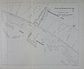
 CONRAD(1859) p245 PLAN VAN DE HAVEN VAN SUEZ.jpg 3,297 × 2,639; 3.52 MB
-
 CONRAD(1859) p253 PLAN VAN DE HAVEN VAN SAID.jpg 3,261 × 2,615; 3.46 MB
-

-

-

-

-

-

-

-

-

-

-

-

-
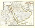
 Egypt and Arabia Petrea - DPLA - dc7c7828b106f234d21c04e4e942bdbf.jpg 1,000 × 755; 242 KB
-
 Egypt and Nubia - DPLA - 5a3efdc0d31846a27e8360b50474b564.jpg 816 × 1,000; 265 KB
-
 Egypt, Arabia Petrea, and the Holy Land (IA egyptarabiapetre00step).pdf 1,158 × 1,808; 376 KB
-
 Egypte Nubie et Abyssinie - DPLA - f321760f813a1fe72ff0e044c5d4550e.jpg 730 × 1,000; 216 KB
-
 Egypte, Palestine et Phnicie - DPLA - 2fc79b923fcab6fde67008c230cf5b18.jpg 728 × 1,000; 189 KB
-

-

-
 Lepsius-Projekt tw 1-1-01.jpg 1,603 × 2,051; 544 KB
-
 Lepsius-Projekt tw 1-1-04.jpg 1,573 × 1,975; 527 KB
-
 Reizen naar de landengte van Suez, Egypte, het Heilige Land (1859), page 186.jpg 3,754 × 3,042; 3.99 MB
-
 Reizen naar de landengte van Suez, Egypte, het Heilige Land (1859)p184.jpg 1,550 × 1,267; 136 KB
-
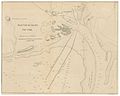
 Suez Bay, Egypt (Justus Perthes' Geographische Anstalt, 1856).jpg 1,510 × 1,278; 386 KB
-
 Suez1856.jpg 1,449 × 1,242; 342 KB
.jpg)
.jpg)
.jpg)

_ROUTE_FROM_CAIRO_TO_KORDOFAN.jpg)

_12.993_Kartenblatt_Arabien,_Nill%C3%A4nder_Afrikas.jpg)

_p128_ROUTE_ON_THE_NILE.jpg)

.jpg)
.jpg)

.jpg)
_p053_PLATTE_GROND_VAN_ALEXANDRIE.jpg)
_p071_PLATTE_GROND_VAN_CAIRO.jpg)
_p245_PLAN_VAN_DE_HAVEN_VAN_SUEZ.jpg)
_p253_PLAN_VAN_DE_HAVEN_VAN_SAID.jpg)
%27_(11034836395).jpg)
.jpg)
_(16146545373).jpg)
_(16559204167).jpg)
_(16579071730).jpg)
_(16740584216).jpg)
_(16765301981).jpg)
_(16765395462).jpg)
_(16766475215).jpg)


,_page_186.jpg)
p184.jpg)
.jpg)

.jpg)