Category:1860s maps of Egypt
Subcategories
This category has the following 2 subcategories, out of 2 total.
- 1863 maps of Egypt (2 F)
- 1865 maps of Egypt (1 F)
Media in category "1860s maps of Egypt"
The following 26 files are in this category, out of 26 total.
-
 Arthur Penrhyn Stanley, Egypt (FL25553457 2367097).jpg 4,171 × 5,254; 29.59 MB
-
 DasRotheMeer1860.jpg 1,567 × 2,687; 1.09 MB
-

-

-
 Stein, Christ. Gottfr. Dan.West-Asien. 1865 H.jpg 1,193 × 2,558; 555 KB
-
 Stein, Christ. Gottfr. Dan.West-Asien. 1865 HA.jpg 951 × 1,840; 329 KB
-
 Stein, Christ. Gottfr. Dan.West-Asien. 1865 HB.jpg 951 × 995; 188 KB
-
 1865 Spruner Map of Arabia and Egypt in Antiquity - Geographicus - Arabia-spruner-1865.jpg 3,500 × 2,649; 2.26 MB
-
 51 of '(Sinai and Palestine, etc.)' (11073510094).jpg 2,336 × 1,522; 929 KB
-
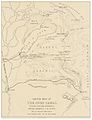 (1866) SKETCH MAP OF THE SUEZ CANAL.jpg 2,737 × 3,557; 4.27 MB
-
 110 of 'The Rob Roy on the Jordan, Nile, Red Sea, & Gennesareth, etc' (11090719813).jpg 2,096 × 1,283; 680 KB
-
 111 of 'The Rob Roy on the Jordan, Nile, Red Sea, & Gennesareth, etc' (11088188094).jpg 2,096 × 1,283; 834 KB
-

-
 Aegyptus from Orbis terrarum antiquus 1861.jpg 1,264 × 1,504; 1.64 MB
-

-
 Diario di un viaggio in Arabia Petrea (1865) BHL48741116.jpg 2,268 × 2,872; 752 KB
-
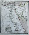
 Egypt - DPLA - 95959e9f6ae6d6b1543412484ff72777.jpg 719 × 1,000; 145 KB
-

-
 Exposition de 1867.jpg 1,024 × 1,373; 372 KB
-
 French language map of Central and Eastern Africa 1862.jpg 7,575 × 8,845; 24.61 MB
-

-
-

-
 Nordstiliches Africa - DPLA - 4f80760cff3720a4697f32ef5af9b200.jpg 794 × 1,000; 222 KB
-

-
 WorldAccordingToStraboReconstructed EgyptNubia cropped.jpg 820 × 1,188; 511 KB
.jpg)

_-_A._Buquet_del._-_btv1b531004430.jpg)


%27_(11073510094).jpg)
_SKETCH_MAP_OF_THE_SUEZ_CANAL.jpg)
.jpg)
.jpg)


_BHL48741116.jpg)


.jpg)
_(14586512637).jpg)
_(14749985156).jpg)


._Turkey_in_Asia,_Transcaucasia._1861_(CB).jpg)
)%27_(11084694893).jpg)