Category:1810s maps of England
Media in category "1810s maps of England"
The following 8 files are in this category, out of 8 total.
-
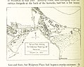 154 of 'The Records of the Woolwich District' (11290142403).jpg 1,511 × 1,201; 448 KB
-

-
 British Map of Herts (BM 1981,U.1003).jpg 2,500 × 1,951; 422 KB
-

-

-
 PINKERTON'S MODERN ATLAS, ENGLAND NORTHERN PART.jpg 8,984 × 6,463; 9.39 MB
-
 PINKERTON'S MODERN ATLAS, ENGLAND SOUTHERN PART.jpg 9,143 × 6,471; 11.36 MB
-
 'Strata of England and Wales' The William Smith Geological Map - High Resolution YORYM 2004 25.jpg 7,465 × 10,555; 68.39 MB
.jpg)
.jpg)

.jpg)


_by_John_Cary._Original_from_The_Beinecke_Rare_Book_%26_Manuscript_Library._Digitally_enhanced_by_rawpixel._(50622865008).jpg)