Category:1830s maps of England
Media in category "1830s maps of England"
The following 12 files are in this category, out of 12 total.
-
 140 of 'The Records of the Woolwich District' (11103459375).jpg 727 × 825; 137 KB
-
 The Useful Knowledge Society's Family Atlas, MAP OF ENGLAND - PART 3.jpg 6,099 × 4,750; 5.31 MB
-
 The Useful Knowledge Society's Family Atlas, MAP OF ENGLAND - PART 4.jpg 6,491 × 4,487; 4.52 MB
-
 The Useful Knowledge Society's Family Atlas, MAP OF ENGLAND - PART 5.jpg 6,307 × 4,519; 5.47 MB
-
 The Useful Knowledge Society's Family Atlas, MAP OF ENGLAND - PART 1.jpg 5,323 × 6,513; 7.06 MB
-
 The Useful Knowledge Society's Family Atlas, MAP OF ENGLAND - PART 2.jpg 6,364 × 5,224; 6.8 MB
-
 Dorset Map 1834.png 2,384 × 1,578; 763 KB
-
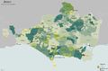
 Gloucestershire 1832 Map.png 1,999 × 2,075; 731 KB
-
 Post Office annual directory (1836) (14585859357).jpg 1,576 × 3,452; 581 KB
-
 Post-Office Annual directory (1835) (14595956299).jpg 2,032 × 3,418; 494 KB
-
 Warwickshire Administrative 1832.png 1,425 × 2,000; 476 KB
-
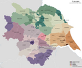 Yorkshire Administrative Map 1832.png 2,410 × 2,000; 690 KB
.jpg)


_(14585859357).jpg)
_(14595956299).jpg)

