Category:1813 maps of Canada
| ← 1813 1814 1815 1816 1817 1818 1819 |
English: Maps of Canada from 1813 or related to Canada in 1813
Français : Les cartes du Canada de 1813 ou se rapportant au Canada en 1813
Subcategories
This category has the following 2 subcategories, out of 2 total.
O
Q
- 1813 maps of Quebec (2 F)
Media in category "1813 maps of Canada"
The following 3 files are in this category, out of 3 total.
-
-
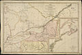
 Eastern lake ontario, published in 1813.png 544 × 776; 760 KB
-
.jpg)

