Category:1818 maps of Canada
Countries of North America: Canada · Mexico · United States of America‡
‡: partly located in North America
‡: partly located in North America
| ← 1813 1814 1815 1816 1817 1818 1819 |
English: Maps of Canada from 1818 or related to Canada in 1818
Français : Les cartes du Canada de 1818 ou se rapportant au Canada en 1818
Media in category "1818 maps of Canada"
The following 2 files are in this category, out of 2 total.
-

-
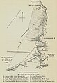 Red River Settlement 1818 -1910- (2739706443).jpg 1,737 × 2,540; 1.08 MB

.jpg)