Category:1817 maps of Canada
Countries of North America: Canada · Mexico · United States of America‡
‡: partly located in North America
‡: partly located in North America
| ← 1813 1814 1815 1816 1817 1818 1819 |
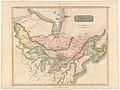
English: Maps of Canada from 1817 or related to Canada in 1817
Français : Les cartes du Canada de 1817 ou se rapportant au Canada en 1817
Media in category "1817 maps of Canada"
The following 5 files are in this category, out of 5 total.
-

-
 Canada and Nova Scotia (4231927152).jpg 2,000 × 1,500; 2.35 MB
-
 Northern provinces of the United States (NYPL b13858100-434391).jpg 4,913 × 3,890; 3.92 MB
-
 Selkirk Treaty Map.jpg 2,368 × 3,744; 1.93 MB
-
 William Dassauville, Canada and Nova Scotia (FL13730014 2534866).jpg 11,659 × 8,709; 136.34 MB
_(2182564833).jpg)
.jpg)
.jpg)

.jpg)