Category:1820s maps of India
Subcategories
This category has the following 6 subcategories, out of 6 total.
- 1820 maps of India (2 F)
- 1823 maps of India (6 F)
- 1824 maps of India (2 F)
- 1825 maps of India (2 F)
- 1829 maps of India (empty)
Media in category "1820s maps of India"
The following 10 files are in this category, out of 10 total.
-

-
 1821 Carey Map of India - Geographicus - India-carey-1821 (cropped).jpg 3,136 × 3,333; 2.57 MB
-
 1821 Carey Map of India - Geographicus - India-carey-1821.jpg 5,000 × 4,130; 6.29 MB
-

-
 F28-32 1829 Map of the Province of Kumaon by Webb.jpg 19,552 × 19,781; 19.05 MB
-
 Historical Records of the Survey of India Vol.-3.pdf 1,816 × 2,641, 590 pages; 43.84 MB
-
 Map of Kumaun & Garhwal, Survey of India 1827.jpg 547 × 581; 264 KB
-
 Map of Tibet in 1821 Carey Map of India - Geographicus - India-carey-1821 (cropped).jpg 1,942 × 1,062; 541 KB
-

-

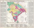
_in_1820,_from-_World_cyclopedia_1820_(cropped).jpg)
.jpg)

.jpg)


.jpg)
_(page_3_crop_from_book).jpg)
.jpg)