Category:1850s maps of the Ottoman Empire
Subcategories
This category has the following 17 subcategories, out of 17 total.
- 1853 maps of the Ottoman Empire (10 F)
'
- 1850s maps of Albania (3 F)
- 1850s maps of Bulgaria (7 F)
.
- 1850s maps of Cyprus (2 F)
- 1850s maps of Iraq (5 F)
- 1850s maps of Jordan (1 F)
Media in category "1850s maps of the Ottoman Empire"
The following 21 files are in this category, out of 21 total.
-
1850s map - Generalkarte der Europäischen Türkei und des Vladikats Montenegro.jpg 18,703 × 16,358; 55.07 MB
-
(1853) MAP OF LOWER DANUBIA.jpg 3,131 × 2,568; 3.47 MB
-
1854 Carte de l'empire de Turquie en Europe et en Asie (cropped).jpg 12,654 × 8,869; 15.44 MB
-
1854 Carte de l'empire de Turquie en Europe et en Asie.jpg 15,680 × 9,544; 17.72 MB
-
1854 Map of the frontier provinces of Turkey, Russia & Austria, the Black Sea, &c.tif 8,044 × 5,964; 137.28 MB
-
Ca. 1854 Portuguese map of the Balkans.jpg 2,534 × 3,500; 1.44 MB
-
The Danubian Principalities, Prepared From The Vienna Map in 21 Sheets.jpg 32,510 × 33,257; 302.33 MB
-
1854 map of the Eastern Balkan peninsula during the Crimean War.jpg 5,959 × 8,500; 14.99 MB
-
1855 map - Carte du Théâtre de la Guerre.jpg 10,800 × 7,500; 24.31 MB
-
Atlas over alle Jordens Dele - no-nb digibok 2010021603001-35.jpg 3,924 × 3,217; 2.36 MB
-
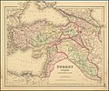
Colton's Turkey in Asia and the Caucasian Provinces of Russia.jpg 9,676 × 8,079; 18 MB
-
1858 map by H. Kiepert - Karte von Armenien, Kurdistan und Azerbeidschan.jpg 13,278 × 8,941; 32.97 MB
-
1858 map by H. Kiepert - Karte von Armenien, Kurdistan und Azerbeidschan.png 13,278 × 8,941; 297.42 MB
-
Das Mittelländische und Schwarze Meer Nebst Übersicht Der Länder Des Osmanischen Reichs.jpg 5,607 × 4,581; 8.62 MB
-
Das Osmanische Reich in Asien (Klein-Asien, Armenien, Kurdistan, Mesopotamien, Syrien).jpg 5,620 × 4,579; 8.97 MB
-
Die Europaeische Türkei, Griechenland und die Ionischen Inseln.jpg 5,570 × 4,553; 9.19 MB
-
Die Europaeische Türkei.jpg 5,559 × 4,554; 10.25 MB
-
North East Sheet General-Karte von der Europaischen Turkei 1853.jpg 7,018 × 5,539; 7.77 MB


