Category:1851 maps
| ← · 1850 · 1851 · 1852 · 1853 · 1854 · 1855 · 1856 · 1857 · 1858 · 1859 · → |
Deutsch: Karten mit Bezug zum Jahr 1851
English: Maps related to the year 1851
Español: Mapas relativos al año 1851
Français : Cartes concernant l’an 1851
Русский: Карты 1851 года
Subcategories
This category has the following 10 subcategories, out of 10 total.
Media in category "1851 maps"
The following 100 files are in this category, out of 100 total.
-
 An atlas of antient geography (cartographic material) (IA atlasofantientge00butl 2).pdf 681 × 1,056, 136 pages; 7.56 MB
-

-
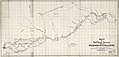
 Map of ERRIS and GALWAY.jpg 3,692 × 4,593; 9.47 MB
-
 THIRLWALL(1851) p6.410 THE MARCHES OF ALEXANDER.jpg 7,137 × 3,569; 11.3 MB
-
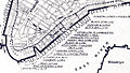
 1851 Bird's-eye view of New York City with Battery Park in the foreground.jpg 3,394 × 2,300; 4.37 MB
-
 1851 Black Map of Norway and Sweden (Scandinavia) - Geographicus - NorwaySweden-black-51.jpg 3,192 × 4,592; 2.43 MB
-
 1851 Map of Georgetown, crop from 1851 Map of the City.jpg 2,964 × 2,944; 5.57 MB
-
 1851 Medford and Stoneham Branch Railroad map.jpg 9,526 × 3,639; 4.5 MB
-

-

-
 A map of the town of Milford, Worcester County, Massachusetts (3120017239).jpg 1,485 × 2,000; 2.79 MB
-

-

-

-

-
 Birds-eye view of New York, 1851.png 3,200 × 2,148; 2.84 MB
-
 Bischberg und Umgebung 1851.jpg 1,381 × 1,394; 582 KB
-

-
 Canaan in possession of the twelve tribes of Israel (FL45582988 3925930).jpg 1,215 × 1,889; 962 KB
-
 Canaan of Palestine to illustrate the new Testament (FL45582993 3925935).jpg 1,234 × 2,027; 1.04 MB
-

-

-
 Carte du département de la Haute-Loire - 1851.jpg 11,014 × 7,964; 11.29 MB
-
 Carte routière du département du Jura - 1851.jpg 8,864 × 10,708; 12.3 MB
-
 China. LOC 2006629388.tif 6,471 × 5,360; 99.23 MB
-
-

-
 Colton's township map of the State of Wisconsin LOC 2018588058.jpg 7,385 × 8,528; 10.57 MB
-
 Colton's township map of the State of Wisconsin LOC 2018588058.tif 7,385 × 8,528; 180.19 MB
-
 Cuba in 1851. LOC 2012593347.jpg 7,928 × 6,301; 10.06 MB
-
 Cuba in 1851. LOC 2012593347.tif 7,928 × 6,301; 142.92 MB
-

-

-

-
 Dubai2 082.jpg 2,304 × 1,728; 1.47 MB
-
 Ecuador1851.png 758 × 391; 23 KB
-
 Exchange Ward Manchester Adshead.jpg 1,536 × 1,159; 480 KB
-
 General map of the Countries Mentioned In the Bible (FL45602891 3935170).jpg 3,216 × 2,644; 1.83 MB
-

-

-
 Iconographic Encyclopedia of Science, Literature and Art 062.jpg 2,811 × 2,318; 1.18 MB
-

-
 John Rapkin, Independent Tartary (FL36380642 2622257).jpg 8,649 × 6,231; 75.59 MB
-
 John Rapkin, Modern Palestine (FL51320669 2369431).jpg 6,275 × 8,521; 79.13 MB
-
 John Rapkin, Russia in Asia (FL147394489 2608011).jpg 8,538 × 6,218; 55.93 MB
-
 John Rapkin, Russia in Europe (FL147398619 2607999).jpg 6,166 × 8,551; 56.93 MB
-
 John-Tallis-1851-Tibet-Mongolia-and-Manchuria-NE.jpg 2,100 × 1,400; 2.34 MB
-
 Madeira - Its Climate and Scenery, 1851, map.png 2,500 × 3,963; 202 KB
-
 Maillard, Paris illustré et ses fortifications.jpg 4,382 × 3,422; 8.36 MB
-

-
 Map (of the) borough of Stonington, Connecticut, 1851. LOC 75692234.jpg 6,525 × 8,023; 7.52 MB
-
 Map (of the) borough of Stonington, Connecticut, 1851. LOC 75692234.tif 6,525 × 8,023; 149.78 MB
-

-
 Map of Columbia County, New York - from actual surveys LOC 2012593653.jpg 11,456 × 16,228; 22.75 MB
-
 Map of Lancaster County, Pennsylvania. LOC 2012592191.jpg 13,785 × 12,346; 21.8 MB
-
 Map of Lancaster County, Pennsylvania. LOC 2012592191.tif 13,785 × 12,346; 486.92 MB
-

-

-
 Map of Northampton County, Pennsylvania LOC 2012590206.jpg 10,562 × 8,338; 12.63 MB
-
 Map of Northampton County, Pennsylvania LOC 2012590206.tif 10,562 × 8,338; 251.96 MB
-

-

-
 Map of Providence County, Rhode Island, with some of the adjacent towns LOC 2013591359.jpg 15,938 × 11,954; 25.37 MB
-
 Map of the city of Augusta, capital of the state of Maine LOC 2008624046.jpg 9,560 × 10,826; 10.42 MB
-
 Map of the city of Augusta, capital of the state of Maine LOC 2008624046.tif 9,560 × 10,826; 296.11 MB
-
 Map of the city of Norfolk and the town of Portsmouth. LOC 2009575801.jpg 16,141 × 10,644; 21.24 MB
-

-
-

-
 Map of the town of Millbury (3855700871).jpg 2,000 × 1,339; 2.18 MB
-
 Map of the town of Wrentham (7557395614).jpg 5,888 × 7,608; 43.51 MB
-
 Map of the village of Concord, Merrimack County, N.H. (9144002304).jpg 667 × 800; 105 KB
-
 Meyer‘s Zeitungsatlas 106 – Holstein mit Lauenburg, Hamburg und Lübeck.jpg 7,243 × 6,070; 15.86 MB
-
 Persian Gulf, detail from Old Map of Arabia 1851 by Tallis & Rapkin.jpg 900 × 797; 180 KB
-
 Persian-gulf-dubai-mus.JPG 1,254 × 813; 116 KB
-

-

-

-
 Plan of Newburyport Mass. from an actual survey (3855701881).jpg 2,000 × 1,402; 2.44 MB
-
 Plan of part of Mystic River, with common low water mark of line of flats (2675201136).jpg 2,000 × 1,281; 2.24 MB
-
 Plan of the city of Baltimore, Maryland LOC 2004629026.jpg 13,414 × 10,643; 27.75 MB
-
 Plan of the town of Meriden, New Haven County, Connecticut (7557602798).jpg 2,000 × 1,743; 3.08 MB
-
 Plan showing proposed method of laying out the public grounds at Washington LOC 94681554.jpg 20,590 × 13,411; 24.79 MB
-
 Plan showing proposed method of laying out the public grounds at Washington LOC 94681554.tif 20,590 × 13,411; 790.02 MB
-
 Plan topographique et géométrique des communes d'Arles et des Saintes-Maries - 1851.jpg 13,583 × 10,766; 25.24 MB
-
 Plano de Manila 1851.jpg 2,609 × 2,067; 850 KB
-
 Plànol Sant Feliu de Llobregat 1851.jpg 2,631 × 2,071; 668 KB
-
 Port of New York 1851.jpg 766 × 432; 363 KB
-
 Qalaherriaiq map.jpg 1,013 × 1,293; 266 KB
-
 Raum bischberg2.jpg 1,291 × 1,288; 1.52 MB
-
 S. S. Downin's plat of Joseph Poffenberger LOC 2005625030.jpg 7,267 × 4,267; 2.33 MB
-
 S. S. Downin's plat of Joseph Poffenberger LOC 2005625030.tif 7,267 × 4,267; 88.72 MB
-
 Skeleton map of rail-roads between Cape Canso and St. Louis (2673752555).jpg 2,000 × 1,517; 2.47 MB
-

-
 Skeleton map of rail-roads between Cape Canso and St. Louis, LOC gm70002892.jpg 9,809 × 7,131; 9.78 MB
-
 Skeleton map of rail-roads between Cape Canso and St. Louis, LOC gm70002892.tif 9,809 × 7,131; 200.12 MB
-
 Tarapaca peru 1851.jpg 1,572 × 3,039; 876 KB
-
 The Holy Land and lower Egypt (FL35098684 3892706).jpg 3,803 × 5,640; 29.88 MB
-
 Trade wind chart of the Atlantic Ocean LOC 2009575918.jpg 10,914 × 7,383; 11.98 MB
-
 Trade wind chart of the Atlantic Ocean LOC 2009575918.tif 10,914 × 7,383; 230.54 MB
%27_(11036962446).jpg)

_p6.410_THE_MARCHES_OF_ALEXANDER.jpg)

_-_Geographicus_-_NorwaySweden-black-51.jpg)


_..._Con_un_plano_y_dos_vistas_de_la_capital%27_(11036017046).jpg)
.jpg)
.jpg)


_(20243874078).jpg)
.jpg)
.jpg)


.jpg)


.jpg)
.jpg)
.jpg)
.jpg)


_borough_of_Stonington,_Connecticut,_1851._LOC_75692234.jpg)


.jpg)

.jpg)
.jpg)
.jpg)


_(14597615467).jpg)
.jpg)
.jpg)
.jpg)
.jpg)

.jpg)


.jpg)


.jpg)
