Category:1858 maps
| ← · 1850 · 1851 · 1852 · 1853 · 1854 · 1855 · 1856 · 1857 · 1858 · 1859 · → |
Deutsch: Karten mit Bezug zum Jahr 1858
English: Maps related to the year 1858
Español: Mapas relativos al año 1858
Français : Cartes concernant l’an 1858
Русский: Карты 1858 года
Subcategories
This category has the following 10 subcategories, out of 10 total.
Media in category "1858 maps"
The following 132 files are in this category, out of 132 total.
-

-
-

-

-
 FAIRBANKS(1858) p030 Map of Florida in 1565.jpg 1,321 × 1,653; 602 KB
-
 FAIRBANKS(1858) p074 Map of the mouth of St. Johnes River.jpg 1,077 × 703; 456 KB
-
 VILLAVICENCIO(1858) p307 PLANO DE LA CIUDAD DE QUITO - 1858.jpg 2,352 × 1,480; 2.22 MB
-
 VILLAVICENCIO(1858) p483 PLANO DE LA CIUDAD DE GUAYAQUIL - 1858.jpg 2,347 × 1,504; 2.39 MB
-
 1858 Colton's Map of the Western Hemisphere - Geographicus - WesternHemi-colton-1858.jpg 3,042 × 3,444; 1.26 MB
-
 1858 Dufour Map of the United States - Geographicus - UnitedStates-dufour-1858.jpg 5,000 × 3,688; 5.11 MB
-
 SCOTT(1858) Map of West Africa (Liberia).jpg 590 × 750; 304 KB
-
 1858 map of the Austrian Empire by John Arrowsmith.jpg 14,652 × 11,966; 39.73 MB
-
-
 A map of Harford Co., Maryland, 1858. LOC 2002624034.tif 12,528 × 15,648; 560.87 MB
-
 Atlantic cable Map.jpg 1,493 × 600; 163 KB
-
 Bouhans-lès-Lure.jpg 2,048 × 1,536; 823 KB
-
 Carte routière et hydrographique de Seine-et-Marne - 1858.jpg 8,324 × 10,860; 13.02 MB
-
 Carte routière, historique et monumentale des environs de Saumur.jpg 7,008 × 5,338; 6.42 MB
-
 Carte routière, statistique et administrative du département de Maine-et-Loire - 1858.jpg 9,152 × 7,202; 11.44 MB
-
 CañasJerez.jpg 564 × 399; 24 KB
-
 Centre ville de Lure 1858.jpg 2,048 × 1,536; 879 KB
-
 Charles William Meredith van de Velde, Carte du Pays d'Israel (FL199992168 2369095).jpg 6,320 × 8,819; 17.77 MB
-
 Charles William Meredith van de Velde, Map of the Holy Land 01 (FL199992294 2369094).jpg 7,120 × 6,048; 15.29 MB
-
 Charles William Meredith van de Velde, Map of the Holy Land 01 (FL37825742 3923551).jpg 11,285 × 9,209; 125.94 MB
-
 Charles William Meredith van de Velde, Map of the Holy Land 02 (FL199992295 2369094).jpg 7,312 × 6,088; 22.27 MB
-
 Charles William Meredith van de Velde, Map of the Holy Land 02 (FL37825747 3923551).jpg 11,410 × 9,487; 157.83 MB
-
 Charles William Meredith van de Velde, Map of the Holy Land 03 (FL199992296 2369094).jpg 7,240 × 6,048; 22.23 MB
-
 Charles William Meredith van de Velde, Map of the Holy Land 03 (FL37825753 3923551).jpg 11,193 × 9,230; 141.15 MB
-
 Charles William Meredith van de Velde, Map of the Holy Land 04 (FL199992297 2369094).jpg 7,240 × 6,048; 20.24 MB
-
 Charles William Meredith van de Velde, Map of the Holy Land 04 (FL37825764 3923551).jpg 11,150 × 9,285; 145.84 MB
-
 Charles William Meredith van de Velde, Map of the Holy Land 05 (FL199992298 2369094).jpg 7,200 × 6,048; 19.92 MB
-
 Charles William Meredith van de Velde, Map of the Holy Land 05 (FL37825775 3923551).jpg 11,291 × 9,280; 151.36 MB
-
 Charles William Meredith van de Velde, Map of the Holy Land 06 (FL199992299 2369094).jpg 7,232 × 6,048; 20.23 MB
-
 Charles William Meredith van de Velde, Map of the Holy Land 06 (FL37825787 3923551).jpg 11,137 × 9,246; 146.14 MB
-
 Charles William Meredith van de Velde, Map of the Holy Land 07 (FL199992300 2369094).jpg 7,288 × 6,000; 21.77 MB
-
 Charles William Meredith van de Velde, Map of the Holy Land 07 (FL37825795 3923551).jpg 11,211 × 9,252; 147.76 MB
-
 Charles William Meredith van de Velde, Map of the Holy Land 08 (FL199992301 2369094).jpg 7,312 × 6,048; 21.37 MB
-
 Charles William Meredith van de Velde, Map of the Holy Land 09-Entire-Map (FL199992302 2369094).jpg 10,423 × 15,848; 146.02 MB
-
 Charles William Meredith van de Velde, Plan de Jérusalem (FL6882260 2368195).jpg 2,100 × 2,921; 3.21 MB
-
 Charles William Meredith van de Velde, Plan of Jerusalem (FL184621859 2370465).jpg 5,920 × 5,656; 13.66 MB
-

-
 Chart of the submarine Atlantic Telegraph LOC 2013593216.jpg 7,603 × 4,209; 5.39 MB
-
 Chart of the submarine Atlantic Telegraph LOC 2013593216.tif 7,603 × 4,209; 91.56 MB
-
 China. LOC 2006629369.tif 6,918 × 5,414; 107.16 MB
-
 City of Washington. LOC 88694016.jpg 5,218 × 4,057; 3.75 MB
-
 City of Washington. LOC 88694016.tif 5,218 × 4,057; 60.57 MB
-
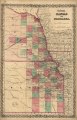
 Colton's Kansas and Nebraska. LOC 2003627015.jpg 5,194 × 8,081; 6.62 MB
-
 Colton's Kansas and Nebraska. LOC 2003627015.tif 5,194 × 8,081; 120.09 MB
-
 Die Gartenlaube (1858) 245.jpg 1,750 × 2,379; 1.09 MB
-
 Die Gartenlaube (1858) 421.jpg 1,750 × 2,379; 1.2 MB
-
 Euclid Township 1858 old.jpg 2,596 × 3,160; 6.86 MB
-
 Euclid Township 1858.jpg 1,873 × 2,245; 2.49 MB
-
 Everest 1858.jpg 1,500 × 1,046; 228 KB
-
 Heilbronn Stadtplan 1858.jpg 3,130 × 3,261; 3.05 MB
-
 Herzogthum Steyermark 1858.jpg 2,835 × 3,474; 7.94 MB
-
 Indiana, Illinois, Missouri & Iowa with parts of adjoining states. LOC gm70002853.jpg 10,229 × 7,262; 12.64 MB
-
 Indiana, Illinois, Missouri & Iowa with parts of adjoining states. LOC gm70002853.tif 10,229 × 7,262; 212.53 MB
-

-
-
 Israels zug aus AEgypten ins land Kanaan (FL32714874 3876822).jpg 6,544 × 5,304; 38.27 MB
-
 Iutit nunata assinga (FL199985535 2368769).jpg 2,056 × 3,052; 2.8 MB
-

-
 JerusalemMapJTBarclay1858.png 2,500 × 3,750; 3.04 MB
-
 Lorenz Clemens Gratz, Das Heutige Jerusalem (FL198245546 1141891).jpg 5,286 × 6,946; 34.69 MB
-
 Lure vue centrée 1858.jpg 2,048 × 1,536; 903 KB
-
 Lure vue globale carte 1858.jpg 1,536 × 2,048; 940 KB
-

-
 Map of Fond du Lac County, Wisconsin LOC 2012593195.jpg 18,015 × 15,041; 38.69 MB
-
 Map of Fond du Lac County, Wisconsin LOC 2012593195.tif 18,015 × 15,041; 775.23 MB
-

-
-
 Map of Indre et Loire by Alexandre Vuillemin 1858.jpg 1,952 × 2,519; 625 KB
-

-

-
 Map of Ladakh or Little Tibet (Klein Tubet) in 1858 Vorder-Asien (cropped).jpg 777 × 1,143; 473 KB
-

-
 Map of Talbot County; with farm limits. LOC 2002624021.jpg 11,489 × 11,375; 20.15 MB
-
 Map of Talbot County; with farm limits. LOC 2002624021.tif 11,489 × 11,375; 373.9 MB
-
-

-

-
 Map of the county of Milwaukee, Wisconsin LOC 2012593643.jpg 19,320 × 15,538; 42.11 MB
-
 Map of the Illinois River Rail Road (NBY 1352).jpg 2,384 × 3,600; 1.09 MB
-

-

-

-
 Map of the road to Hell!! LOC 2013585074.jpg 8,826 × 6,377; 7.51 MB
-
 Map of the road to Hell!! LOC 2013585074.tif 8,826 × 6,377; 161.03 MB
-

-
 Map of Washington County, Vermont (3121050248).jpg 2,000 × 1,999; 3.94 MB
-
-
 Mapa de la republica de Nicaragua. LOC 99466743.jpg 9,621 × 7,227; 13.9 MB
-
 Mare tribal boundaries 1850s.jpg 1,252 × 1,622; 282 KB
-
 Martenet's Map of Cecil County, Maryland - from the coast, and original surveys LOC 2002624017.jpg 12,988 × 13,262; 32.7 MB
-
 Martenet's Map of Cecil County, Maryland - from the coast, and original surveys LOC 2002624017.tif 12,988 × 13,262; 492.8 MB
-
 Melisey.jpg 2,048 × 1,536; 821 KB
-
 Moffans.jpg 2,048 × 1,536; 834 KB
-
 Mollans.jpg 2,048 × 1,536; 787 KB
-
 National Library of Israel - Carel Willem Meredith van de Velde Plan of Jerusalem.jpg 2,366 × 2,193; 868 KB
-
 New map of Burlington County - from actual surveys & official records LOC 2004629244.jpg 10,310 × 19,068; 27.08 MB
-
 New map of Burlington County - from actual surveys & official records LOC 2004629244.tif 10,310 × 19,068; 562.45 MB
-
-
 Norman's chart of the lower Mississippi River, LOC 78692178.jpg 9,452 × 19,117; 24.76 MB
-
 Norman's chart of the lower Mississippi River, LOC 78692178.tif 9,452 × 19,117; 516.97 MB
-
 Original map of St Johns Wood Ashgrove 1858.jpg 2,239 × 1,433; 968 KB
-
 Palante Clairegoutte Magny-Danigon Magny-Jobert.jpg 2,048 × 1,536; 845 KB
-

-

-
 Planta da cidade do Rio de Janeiro LOC 2012593120.jpg 12,064 × 8,183; 14.5 MB
-
 Planta da cidade do Rio de Janeiro LOC 2012593120.tif 12,064 × 8,183; 282.44 MB
-
 Profile of 6th Street between Frederick and Market streets LOC 88693340.jpg 3,729 × 4,830; 2.33 MB
-
 Profile of 6th Street between Frederick and Market streets LOC 88693340.tif 3,729 × 4,830; 51.53 MB
-
-

-

-

-

-

-

-

-
 Rio Colorado of the West LOC 79692915.tif 10,701 × 4,739; 145.09 MB
-
 Rio Colorado of the West. NYPL1952950.tiff 9,416 × 4,112; 110.78 MB
-
 Slm1858.jpg 1,197 × 1,456; 180 KB
-
 T-726.jpg 11,066 × 7,118; 2.1 MB
-
 T-727.jpg 11,790 × 7,268; 2.46 MB
-
 Telegraph chart (7557405786).jpg 4,536 × 5,704; 27.41 MB
-

-
 Transatlantic submarine cable map.jpg 2,500 × 984; 1,015 KB
-
 Ungarn, Siebenbürgen, Woiwodina und Slavonien.jpg 5,540 × 4,509; 10.9 MB
-
 Vorder-Asien.jpg 5,351 × 4,501; 9.16 MB
-
 William Hughes, Syria (FL173321217 2567364).jpg 8,446 × 10,611; 97.17 MB
-
 Голендерня на карті Білої Церви 1858 р..jpg 2,244 × 1,536; 593 KB
_LOC_87694237.jpg)
%27_(11055241925).jpg)

_p030_Map_of_Florida_in_1565.jpg)
_p074_Map_of_the_mouth_of_St._Johnes_River.jpg)
_p307_PLANO_DE_LA_CIUDAD_DE_QUITO_-_1858.jpg)
_p483_PLANO_DE_LA_CIUDAD_DE_GUAYAQUIL_-_1858.jpg)


_Map_of_West_Africa_(Liberia).jpg)


.jpg)
.jpg)
.jpg)
.jpg)
.jpg)
.jpg)
.jpg)
.jpg)
.jpg)
.jpg)
.jpg)
.jpg)
.jpg)
.jpg)
.jpg)
.jpg)
.jpg)
.jpg)
.jpg)
.jpg)


_245.jpg)
_421.jpg)


.jpg)
.jpg)


.jpg)


_in_1858_Vorder-Asien_(cropped).jpg)
.jpg)


.jpg)


.jpg)


_(24157387491).jpg)


_LOC_88693303.jpg)
_LOC_88693339.jpg)
_LOC_88693342.jpg)


.jpg)
_(14784913295).jpg)


.jpg)
