Category:1859 maps
| ← 1850 1851 1852 1853 1854 1855 1856 1857 1858 1859 → |
Deutsch: Karten mit Bezug zum Jahr 1859
English: Maps related to the year 1859
Español: Mapas relativos al año 1859
Français : Cartes concernant l’an 1859
Русский: Карты 1859 года
Subcategories
This category has the following 8 subcategories, out of 8 total.
Media in category "1859 maps"
The following 138 files are in this category, out of 138 total.
-
 CONRAD(1859) p053 PLATTE GROND VAN ALEXANDRIE.jpg 1,353 × 2,041; 1.31 MB
-
 CONRAD(1859) p071 PLATTE GROND VAN CAIRO.jpg 2,647 × 1,982; 2.74 MB
-
 CONRAD(1859) p245 PLAN VAN DE HAVEN VAN SUEZ.jpg 3,297 × 2,639; 3.52 MB
-
 CONRAD(1859) p253 PLAN VAN DE HAVEN VAN SAID.jpg 3,261 × 2,615; 3.46 MB
-
 CONRAD(1859) p493 PLATTE GROND VAN DE KERK VAN HET H. GRAF.jpg 5,164 × 3,710; 1.62 MB
-
 CONRAD(1859) p503 PLATTE GROND VAN JERUZALEM.jpg 1,866 × 2,460; 2.47 MB
-
 CONRAD(1859) p715 WERELDKAART AAN HET EIND.jpg 4,191 × 3,381; 5.57 MB
-
 (1879) Übersichtskarte (in russisch) zu Wasserstraßen und Schienennetze der USA.jpg 1,823 × 1,568; 2.07 MB
-
 Шпилевская (1859) p287 Вильманстранд.jpg 834 × 777; 526 KB
-
 Шпилевская (1859) p289 Вильманстранд.jpg 4,475 × 4,033; 8.41 MB
-
 Шпилевская (1859) p291 Фридрихсга́м.jpg 3,173 × 2,759; 4.06 MB
-
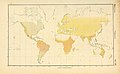
 1859 Delamarche Case Map of the World - Geographicus - World-delamarche-1859.jpg 6,000 × 4,146; 6.65 MB
-
-
 1859 Gloucester Harbour, Village (2675625252).jpg 2,000 × 1,455; 2.43 MB
-

-

-
 1859 U.S. Coast Survey Map of Florida - Geographicus - Florida-uscs-1859.jpg 2,747 × 4,000; 1.38 MB
-

-
-

-

-
 2fi2673 Plan du lycée impérial.jpg 8,086 × 5,475; 1.58 MB
-

-

-

-
 B21365805 0002 orig 0223.png 2,364 × 3,048; 8.06 MB
-
 Birds eye view New York City crop.jpeg 682 × 450; 83 KB
-
 Birds eye view New York City.jpeg 5,662 × 4,066; 5.57 MB
-

-

-
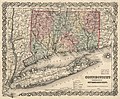 Connecticut with portions of New York & Rhode Island. LOC 2012593353.jpg 4,892 × 4,034; 4.35 MB
-
 Connecticut with portions of New York & Rhode Island. LOC 2012593353.tif 4,892 × 4,034; 56.46 MB
-
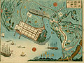 Detailed map of the developed port of Yokohama (15205894711).jpg 2,500 × 1,880; 2.39 MB
-
 Die Klassen und Ordnungen des Thier-Reichs (9390844341).jpg 3,200 × 1,974; 875 KB
-

-
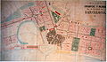
 EixampleBCN-projecteGarriga.jpg 1,572 × 964; 1,007 KB
-
 EixampleBCN-projecteRovira.jpg 1,548 × 1,038; 777 KB
-
 EixampleBCN-projecteSoler.jpg 1,406 × 824; 644 KB
-

-

-
 Emmanuel Guillaume-Rey, Reconaissance topographique de la Tribu de Juda 03 (FL199986016 2368983).jpg 14,571 × 10,557; 206.27 MB
-
 Ensanche - eixample - Barcelona.jpg 2,498 × 1,659; 887 KB
-
 Farm map of Plumstead Township, Bucks Co., Penn'a LOC 2012585911.jpg 15,899 × 10,872; 19.73 MB
-
 Figuratieve kaart der afdeeling Accra en Berkoe (1859).jpg 4,828 × 3,868; 2.21 MB
-
 Planta exata da Capital do Ceara 1859.jpg 1,006 × 978; 432 KB
-
 From Fort Smith to the Rio Grande - from explorations and surveys LOC 98688420.jpg 16,160 × 7,040; 12.68 MB
-
 From Fort Smith to the Rio Grande - from explorations and surveys LOC 98688420.tif 16,160 × 7,040; 325.49 MB
-
 From the Pimas villages to Fort Fillmore - from explorations and surveys LOC 98688427.jpg 11,820 × 7,495; 9.31 MB
-
 From the Pimas villages to Fort Fillmore - from explorations and surveys LOC 98688427.tif 11,820 × 7,495; 253.46 MB
-
 From the Red River to the Rio Grande LOC 98688435.jpg 14,528 × 7,248; 11.91 MB
-
 From the Red River to the Rio Grande LOC 98688435.tif 14,528 × 7,248; 301.26 MB
-
 From the Rio Grande to the Pacific Ocean - from explorations and surveys LOC 98688421.jpg 15,389 × 6,949; 13.28 MB
-
 From the Rio Grande to the Pacific Ocean - from explorations and surveys LOC 98688421.tif 15,389 × 6,949; 305.95 MB
-
 Gall & Inglis' map of Palestine (FL35084344 3890508).jpg 12,923 × 15,626; 262.61 MB
-
 Geer's New map of the city of Hartford - from the latest surveys. LOC 79695213.jpg 3,398 × 4,748; 2.41 MB
-
 Geer's New map of the city of Hartford - from the latest surveys. LOC 79695213.tif 3,398 × 4,748; 46.16 MB
-
-
 Gulf-of-Carpentaria-Australia-Otto-Petri-1859-Rotterdam.jpg 640 × 480; 125 KB
-

-

-
 J. Sage & Sons new & reliable rail road map, travellers edition, Eastern. LOC 98688363.jpg 6,875 × 5,043; 6.92 MB
-
 J. Sage & Sons new & reliable rail road map, travellers edition, Eastern. LOC 98688363.tif 6,875 × 5,043; 99.19 MB
-
 J. T. Assheton, Historisk charta oefver Palestina eller det Heliga Landet (FL4536649 2368321).jpg 12,837 × 18,131; 346.7 MB
-
 J.W. Scheffelaar (1859) Kaart van de afdeeling Chama, kust van Guinea.jpg 8,622 × 6,319; 15.06 MB
-
 John Bartholomew, Jerusalem (FL6882058 2369597).jpg 2,150 × 2,829; 2.28 MB
-
-

-
 Julius Eduard Braselmann, Plan des Alten Jerusalem (FL45582314 3918479).jpg 2,482 × 1,958; 2.16 MB
-
 Julius Vitringa Coulon (1859) Figuratieve kaart der afdeeling Axim, kust van Guinea.jpg 7,767 × 14,124; 4.39 MB
-
 Kaart van de afdeeling Boutry, Kust van Guinea (1859).jpg 4,823 × 3,745; 1.36 MB
-
 Kaart van de afdeeling Elmina (1859).jpg 5,000 × 4,026; 1.41 MB
-
 Karta öfver Palestina (FL36566121 3913271).jpg 5,188 × 6,268; 45.91 MB
-
 Karte Des Alsterflusses (1859).jpg 5,763 × 5,820; 5.9 MB
-
 Karte vom Amerikanischen Polynesien 1859.jpg 2,034 × 1,564; 546 KB
-
 Kastellet 1859.djvu 4,007 × 3,307; 1.25 MB
-
 Kastellet 1859.jpg 4,007 × 3,307; 2.99 MB
-

-
 Map of Blair County, Pennsylvania - from special surveys LOC 2012590183.jpg 14,023 × 17,486; 34.7 MB
-

-

-

-

-
 Map of Hancock County, Illinois LOC 2013593101.jpg 17,770 × 16,773; 57.38 MB
-
 Map of Herkimer County, New York LOC 2013593067.jpg 17,552 × 17,150; 37.97 MB
-
 Map of Kent County, Delaware - from actual surveys LOC 2013593082.jpg 16,040 × 17,987; 35.59 MB
-
 Map of Kent County, Delaware - from actual surveys LOC 2013593082.tif 16,040 × 17,987; 825.44 MB
-
 Map of Middlesex County, Connecticut. LOC 2001620491.jpg 15,331 × 14,870; 35.59 MB
-
 Map of Monroe County, Michigan, 1859.jpg 18,899 × 13,606; 48.07 MB
-

-
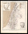
 Map of Palestine or the Holy Land (FL37128357 3904902).jpg 3,195 × 2,238; 4.21 MB
-

-
 Map of the city of Newark, state of New Jersey LOC 2011593692.jpg 3,347 × 2,904; 1.42 MB
-
 Map of the city of Newark, state of New Jersey LOC 2011593692.tif 3,347 × 2,904; 27.81 MB
-
 Map of the counties of Orleans, Lamoille, and Essex, Vermont LOC 2012586229.jpg 16,696 × 16,836; 43.93 MB
-
 Map of the counties of Orleans, Lamoille, and Essex, Vermont LOC 2012586229.tif 16,696 × 16,836; 804.22 MB
-
 Map of the County of Stephenson Illinois LOC 2013593094.jpg 17,645 × 16,676; 41.06 MB
-
 Map of the Northern Rail Road of New Jersey. LOC gm70005020.jpg 18,730 × 6,526; 18.29 MB
-

-
 Map of the recently discovered gold regions in Western Kansas & Nebraska LOC 2004629248.tif 6,831 × 7,331; 143.27 MB
-

-
 Map of the Toledo, Wabash, and Gt. Western Rail Road Line, and its connections. LOC 98688829.tif 3,354 × 1,601; 15.36 MB
-
 Map of the town of Plymouth, Windsor County, Vermont. LOC 2008624018.jpg 9,396 × 10,148; 14.37 MB
-
 Map of the town of Plymouth, Windsor County, Vermont. LOC 2008624018.tif 9,396 × 10,148; 272.8 MB
-
 Map of the Traditional Sinai (FL35469054 2369408).jpg 4,000 × 5,153; 29.18 MB
-
 Map of wagon routes in Utah Territory LOC 2012586633.jpg 15,323 × 9,079; 13.99 MB
-
 Map of wagon routes in Utah Territory LOC 2012586633.tif 15,323 × 9,079; 398.02 MB
-
 Map of Waldo County, Maine LOC 2011589602.jpg 16,012 × 20,825; 40.01 MB
-
 Mapa de Cataluña dividido en sus actuales provincias.jpg 5,081 × 4,183; 3.01 MB
-
 Mapa general de la Republica de la Guatemala. LOC 2012586638.jpg 12,451 × 11,040; 18.95 MB
-
 Mapa general de la Republica de la Guatemala. LOC 2012586638.tif 12,451 × 11,040; 393.27 MB
-
 Massachusetts Encampment, Concord, September 7, 8, and 9, 1859 (2673784191).jpg 1,977 × 2,000; 3.58 MB
-
 Mitchell's sectional map of Kansas LOC 2005625305.jpg 8,970 × 7,420; 10.53 MB
-
 Mitchell's sectional map of Kansas LOC 2005625305.tif 8,970 × 7,420; 190.42 MB
-
 Monsoon & trade wind chart of the Indian Ocean LOC 2009575919.jpg 10,907 × 5,209; 8.5 MB
-
 Monsoon & trade wind chart of the Indian Ocean LOC 2009575919.tif 10,907 × 5,209; 162.55 MB
-
 New & reliable rail road map, travellers edition, Western. LOC 98688395.jpg 7,204 × 5,130; 6.35 MB
-
 New & reliable rail road map, travellers edition, Western. LOC 98688395.tif 7,204 × 5,130; 105.73 MB
-
 New map of Burlington County - from actual surveys & official records LOC 2012586903.jpg 14,996 × 18,155; 33.14 MB
-
 New map of Burlington County - from actual surveys & official records LOC 2012586903.tif 14,996 × 18,155; 778.92 MB
-
 Nizny-Novgorod 1859.jpeg 12,291 × 8,393; 15.88 MB
-
 Palaestina (FL37110456 3887181).jpg 9,106 × 10,980; 138.63 MB
-
 Palästina (FL37110315 3887186).jpg 9,783 × 11,557; 166.38 MB
-
 Paris PC 1859 jms.jpg 5,820 × 4,968; 6.28 MB
-
 Peninsula of Sinai (FL35469060 2369415).jpg 4,979 × 5,512; 37.3 MB
-
 Plain of Esdraelon & Galilee (FL6880193 2369413).jpg 2,412 × 2,596; 2.98 MB
-
 Profil en long du Canal Maritime de Suez 01-title (FL46962103 2704477).jpg 5,145 × 7,548; 51.04 MB
-
 Profil en long du Canal Maritime de Suez 02-map (FL46962113 2704477).jpg 45,424 × 7,954; 439.08 MB
-
-
-
 Reizen naar de landengte van Suez, Egypte, het Heilige Land (1859) (14754638306).jpg 3,110 × 2,440; 870 KB
-
 Riviere des Lacs to the Rocky Mountains - from explorations and surveys LOC 98688423.jpg 11,520 × 7,776; 9.17 MB
-
 Riviere des Lacs to the Rocky Mountains - from explorations and surveys LOC 98688423.tif 11,520 × 7,776; 256.29 MB
-
 St. Paul to Riviere des Lacs - from explorations and surveys LOC 98688422.jpg 11,488 × 7,792; 8.29 MB
-
 St. Paul to Riviere des Lacs - from explorations and surveys LOC 98688422.tif 11,488 × 7,792; 256.1 MB
-

-

-
 Zhongxiang Xian bu di shi ba gong quan tu. LOC 94680842.jpg 17,269 × 3,918; 8.03 MB
-
 Zhongxiang Xian bu di shi ba gong quan tu. LOC 94680842.tif 17,269 × 3,918; 193.58 MB
_p053_PLATTE_GROND_VAN_ALEXANDRIE.jpg)
_p071_PLATTE_GROND_VAN_CAIRO.jpg)
_p245_PLAN_VAN_DE_HAVEN_VAN_SUEZ.jpg)
_p253_PLAN_VAN_DE_HAVEN_VAN_SAID.jpg)
_p493_PLATTE_GROND_VAN_DE_KERK_VAN_HET_H._GRAF.jpg)
_p503_PLATTE_GROND_VAN_JERUZALEM.jpg)
_p715_WERELDKAART_AAN_HET_EIND.jpg)
_%C3%9Cbersichtskarte_(in_russisch)_zu_Wasserstra%C3%9Fen_und_Schienennetze_der_USA.jpg)
_p287_%D0%92%D0%B8%D0%BB%D1%8C%D0%BC%D0%B0%D0%BD%D1%81%D1%82%D1%80%D0%B0%D0%BD%D0%B4.jpg)
_p289_%D0%92%D0%B8%D0%BB%D1%8C%D0%BC%D0%B0%D0%BD%D1%81%D1%82%D1%80%D0%B0%D0%BD%D0%B4.jpg)
_p291_%D0%A4%D1%80%D0%B8%D0%B4%D1%80%D0%B8%D1%85%D1%81%D0%B3%D0%B0%CC%81%D0%BC.jpg)

_-_Geographicus_-_StDomingue-dufour-1859.jpg)
.jpg)


.jpg)
.jpg)
_(17980110979).jpg)


.jpg)
.jpg)
.jpg)


.jpg)


.jpg)

.jpg)


.jpg)
_Kaart_van_de_afdeeling_Chama,_kust_van_Guinea.jpg)
.jpg)

.jpg)
_Figuratieve_kaart_der_afdeeling_Axim,_kust_van_Guinea.jpg)
.jpg)
.jpg)
.jpg)
.jpg)


.jpg)


.jpg)
.jpg)


.jpg)


.jpg)


.jpg)
.jpg)

.jpg)
.jpg)
.jpg)

_(14754638306).jpg)


.jpg)
.jpg)