Category:1855 maps of the United States
States of the United States: California · Connecticut · Florida · Illinois · Louisiana · Massachusetts · Missouri · New Mexico · New York · Ohio · Oregon · Pennsylvania · Rhode Island · Texas · Utah · Vermont · Washington – Washington, D.C.
Subcategories
This category has the following 18 subcategories, out of 18 total.
C
- 1855 maps of California (15 F)
- 1855 maps of Connecticut (3 F)
D
- 1855 maps of Washington, D.C. (11 F)
F
- 1855 maps of Florida (7 F)
I
- 1855 maps of Illinois (6 F)
L
- 1855 maps of Louisiana (5 F)
M
- 1855 maps of Massachusetts (24 F)
- 1855 maps of Missouri (empty)
N
- 1855 maps of New Mexico (1 F)
- 1855 maps of New York (state) (20 F)
O
- 1855 maps of Ohio (13 F)
- 1855 maps of Oregon (4 F)
P
R
- 1855 maps of Rhode Island (3 F)
T
- 1855 maps of Texas (3 F)
U
- 1855 maps of Utah (1 F)
V
- 1855 maps of Vermont (1 F)
W
Media in category "1855 maps of the United States"
The following 29 files are in this category, out of 29 total.
-

-
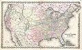 1855 Colton Map of the United States - Geographicus - UnitedStates-colton-1855.jpg 6,000 × 3,660; 7.06 MB
-

-
 1855 Telegraph and Rail Road Map of the New England States.jpg 10,147 × 9,760; 21.05 MB
-

-

-

-
-

-

-

-

-
-

-
 Colton's Map of the United States of America 1855 UTA.jpg 1,800 × 1,068; 2.15 MB
-

-
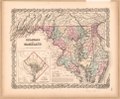
 Delaware and Maryland. LOC 2017593561.jpg 5,689 × 4,710; 4.58 MB
-
 Delaware and Maryland. LOC 2017593561.tif 5,689 × 4,710; 76.66 MB
-
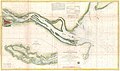
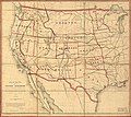
 Map of routes for a Pacific railroad (5121143386).jpg 2,000 × 1,792; 3.13 MB
-
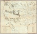
 Map of routes for a Pacific railroad LOC 2007626788.jpg 7,136 × 6,383; 5.19 MB
-
 Map of routes for a Pacific railroad LOC 2007626788.tif 7,136 × 6,383; 130.32 MB
-
-

-
 Map of the United States exhibiting the several collection districts (7557433102).jpg 8,843 × 5,455; 43.23 MB
-
 Nebraska and Kansas LOC 2006458669.jpg 6,694 × 9,014; 10.11 MB
-
 Map of the United States of America showing the rail roads (NYPL b20643909-5564107).tiff 10,328 × 7,760, 2 pages; 229.61 MB
-
 The United States of America (NYPL b20643913-5564104).tiff 10,328 × 7,760, 2 pages; 229.61 MB
-
 Post-kanal-und eisenbahnkarte der verbeinigten staaten von nord-amerika. LOC 2001620438.jpg 8,064 × 6,528; 13.85 MB
-
 Post-kanal-und eisenbahnkarte der verbeinigten staaten von nord-amerika. LOC 2001620438.tif 8,064 × 6,528; 150.61 MB


.jpg)


.jpg)


.jpg)

