Category:1860s maps of Bulgaria
Countries of Europe: Albania · Armenia‡ · Austria · Azerbaijan‡ · Belarus · Belgium · Bosnia and Herzegovina · Bulgaria · Croatia · Cyprus‡ · Czech Republic · Denmark · Estonia · Finland · France‡ · Georgia‡ · Germany · Greece · Hungary · Republic of Ireland · Italy · Latvia · Lithuania · Moldova · Montenegro · Netherlands‡ · Norway · Poland · Portugal‡ · Romania · Russia‡ · Serbia · Slovenia · Spain‡ · Sweden · Switzerland · Turkey‡ · Ukraine · United Kingdom
Limited recognition: Abkhazia‡
‡: partly located in Europe
Limited recognition: Abkhazia‡
‡: partly located in Europe
Media in category "1860s maps of Bulgaria"
The following 2 files are in this category, out of 2 total.
-
 5 - südl Serbien, westl Bulgarien; Scheda-Karte europ Türkei.jpg 5,945 × 4,491; 33.91 MB
-
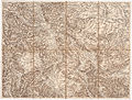
 6 - mittl Bulgarien, Schwarzmeerküste; Scheda-Karte europ Türkei.jpg 5,939 × 4,520; 32.64 MB

