Category:1860s maps of Lithuania
Media in category "1860s maps of Lithuania"
The following 15 files are in this category, out of 15 total.
-
-

-
 1860. Карта Царства Польского (этнограф).jpg 26,750 × 34,000; 58.46 MB
-
 1860. Планы железных дорог.jpg 34,000 × 26,750; 54.04 MB
-

-
 Privisl 1861.jpg 638 × 796; 196 KB
-
 Ethnic composition of the westernmost parts of the Russian Empire, Erckert, 1863.jpg 2,048 × 1,695; 1.27 MB
-
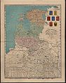
 Atlas of population of the West Russian region of confessions 1864.jpg 7,192 × 9,671; 18.83 MB
-
 Карта народонаселения Гродненской губернии по исповеданиям (1864).jpg 19,647 × 14,598; 24.58 MB
-
 Карта народонаселения Ковенской губернии по исповеданиям (1864).jpg 19,644 × 14,526; 21.22 MB
-
 1865-67 busimos kudros vieta.png 278 × 232; 96 KB
-
 Pirkulių kaimas 1868.jpg 692 × 523; 206 KB
-
 Buidydiškių dvaras 1869.jpg 816 × 532; 247 KB
-
 Suwalszczyzna or Suvalkia regioni, 1869.jpg 3,227 × 4,737; 18.18 MB
-
 Карта народонаселения Виленской губернии по исповеданиям (1864).jpg 19,623 × 14,616; 23.52 MB
.jpg)

.jpg)


.jpg)
.jpg)


.jpg)