Category:1860s maps of Germany
Federal states of Germany:
Subcategories
This category has the following 27 subcategories, out of 27 total.
- 1862 maps of Germany (9 F)
B
- 1860s maps of Berlin (11 F)
- 1860s maps of Brandenburg (3 F)
H
- 1860s maps of Hesse (7 F)
L
- 1860s maps of Lower Saxony (8 F)
M
N
P
- 1860s maps of Prussia (15 F)
R
S
- 1860s maps of Saarland (1 F)
- 1860s maps of Saxony (7 F)
- 1860s maps of Saxony-Anhalt (1 F)
- 1860s maps of Schleswig-Holstein (13 F)
T
Media in category "1860s maps of Germany"
The following 9 files are in this category, out of 9 total.
-
 1862 Stieler Map of Northern Germany - Geographicus - StaatenDeutschen-perthes-1862.jpg 3,132 × 2,600; 1.57 MB
-
 Prussia, and the German States (NYPL b13663520-1510832).jpg 5,012 × 3,985; 6.01 MB
-
 Prussia, and the German States (NYPL b13663520-1510832).tiff 6,299 × 5,248; 95.24 MB
-
 Johnson, A.J. Europe. 1864.F.Germany.jpg 899 × 645; 189 KB
-
 Johnson, A.J. Europe. 1864.F.jpg 1,996 × 2,335; 1.38 MB
-
-
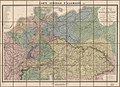
 Carte générale de l'Allemagne comprenant l'ensemble des etats de l'Europe centrale LOC 2015591062.tif 11,512 × 8,309; 273.67 MB
-
 Geological map germany 1869.jpg 1,823 × 2,132; 921 KB
-
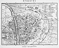 Stadtplan-2-Bahnhöfe.jpg 1,200 × 973; 425 KB

.jpg)


