Category:1883 maps of Massachusetts
States of the United States: California · Connecticut · Florida · Hawaii · Illinois · Indiana · Iowa · Kansas · Louisiana · Maryland · Massachusetts · Michigan · Minnesota · Missouri · Montana · New Hampshire · New Mexico · New York · North Dakota · Ohio · Oregon · Pennsylvania · South Carolina · South Dakota · Texas · Virginia · Washington · Wisconsin · Wyoming
| ← 1880 1881 1882 1883 1884 1885 1886 1887 1888 1889 → |
Media in category "1883 maps of Massachusetts"
The following 7 files are in this category, out of 7 total.
-
 1883 bird's eye view map of Salem, Massachusetts.jpg 11,304 × 6,978; 15.29 MB
-
 Britannica (1882) Massachusetts.jpg 3,751 × 2,707; 1.78 MB
-
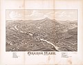
 Orange, Mass. (2674969591).jpg 2,000 × 1,367; 2.1 MB
-
 Orange, Mass. LOC 2019586299.jpg 8,317 × 6,485; 7.75 MB
-
 Orange, Mass. LOC 2019586299.tif 8,317 × 6,485; 154.31 MB
-
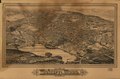
 Woburn, Mass., 1883 LOC 78695092.jpg 10,048 × 6,624; 12.76 MB
-
 Woburn, Mass., 1883 LOC 78695092.tif 10,048 × 6,624; 190.42 MB

_Massachusetts.jpg)
.jpg)

