Category:1883 maps of Texas
States of the United States: California · Connecticut · Florida · Illinois · Iowa · Kansas · Louisiana · Maryland · Massachusetts · Michigan · Minnesota · Missouri · Montana · New Hampshire · New Mexico · New York · North Dakota · Ohio · Oregon · Pennsylvania · South Carolina · South Dakota · Texas · Virginia · Washington · Wisconsin · Wyoming
| ← 1880 1881 1882 1883 1884 1885 1886 1887 1888 1889 → |
Media in category "1883 maps of Texas"
The following 5 files are in this category, out of 5 total.
-

-

-
 Denton, Texas in 1883.jpg 7,200 × 5,511; 20.49 MB
-
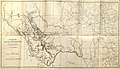 Livermore Military Map of the Rio Grande Frontier 1883 (1926) UTA.jpg 9,477 × 5,448; 13 MB
-

.jpg)
_(14739714766).jpg)

_UTA.jpg)
,_Vol._42,_No._163,_Ed._1_Saturday,_September_1,_1883_-_DPLA_-_3b3a6055ae02932b16ea2ea97232b251_(page_9).jpg)