Category:1887 maps of Texas
States of the United States: California · Connecticut · Florida · Georgia · Iowa · Kansas · Louisiana · Maine · Massachusetts · Michigan · Minnesota · Mississippi · Missouri · New Hampshire · New Jersey · New York · North Carolina · Ohio · Pennsylvania · South Dakota · Tennessee · Texas · Utah · Vermont · Virginia · Washington · Wisconsin · Wyoming
| ← 1880 1881 1882 1883 1884 1885 1886 1887 1888 1889 → |
Media in category "1887 maps of Texas"
The following 3 files are in this category, out of 3 total.
-
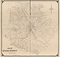
 Map of Bexar County LOC 2008628267.jpg 4,913 × 4,748; 3.19 MB
-
 Map of Bexar County LOC 2012592008.jpg 14,520 × 13,845; 22.98 MB
-


.jpg)