Category:1884 maps of Massachusetts
States of the United States: California · Connecticut · Delaware · Florida · Georgia · Idaho · Illinois · Indiana · Iowa · Kansas · Kentucky · Louisiana · Maine · Massachusetts · Michigan · Minnesota · Missouri · Montana · New Hampshire · New Jersey · New York · North Carolina · North Dakota · Ohio · Oregon · Pennsylvania · South Carolina · South Dakota · Tennessee · Texas · Utah · Vermont · Virginia · Washington · West Virginia · Wisconsin · Wyoming – Washington, D.C.
| ← 1880 1881 1882 1883 1884 1885 1886 1887 1888 1889 → |
Subcategories
This category has the following 2 subcategories, out of 2 total.
B
- 1884 maps of Boston (22 F)
Media in category "1884 maps of Massachusetts"
The following 16 files are in this category, out of 16 total.
-
 1884 Massachusetts railroad map (14574236209).jpg 3,702 × 2,764; 1.8 MB
-
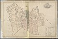
 Arlington, Massachusetts (2675930216).jpg 2,000 × 1,378; 2.52 MB
-
 Atlas-Mass-Holyoke 1884 005.jpg 8,683 × 5,368; 4.44 MB
-

-
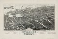 Bird's eye view of the village of Hyannis, Barnstable County, 1884 Mass. 1884. LOC 2013591256.tif 9,303 × 6,165; 164.09 MB
-
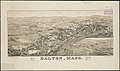 Dalton, Mass. (2673639941).jpg 2,000 × 1,182; 1.74 MB
-
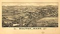 Dalton, Mass. LOC 75694565.jpg 9,648 × 5,376; 10.12 MB
-
 Dalton, Mass. LOC 75694565.tif 9,648 × 5,376; 148.39 MB
-
 Great Barrington, Mass. (2674469020).jpg 2,000 × 1,188; 1.79 MB
-
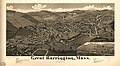 Great Barrington, Mass. LOC 75694575.jpg 9,952 × 5,456; 11.32 MB
-
 Great Barrington, Mass. LOC 75694575.tif 9,952 × 5,456; 155.35 MB
-

-
 Outline and index map of Roxbury, city of Boston (19670639100).jpg 2,000 × 1,347; 2.53 MB
-
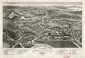 Sandwich Village, Barnstable County, Mass., looking west, 1884 LOC 2011589221.jpg 7,855 × 5,363; 8.32 MB
-
 Sandwich Village, Barnstable County, Mass., looking west, 1884 LOC 2011589221.tif 7,855 × 5,363; 120.52 MB
-
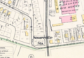 Somerville station on 1884 map.PNG 731 × 504; 735 KB
.jpg)
.jpg)


.jpg)

.jpg)

.jpg)

