Category:1884 maps of Vermont
States of the United States: California · Connecticut · Delaware · Florida · Georgia · Idaho · Iowa · Kansas · Kentucky · Louisiana · Maine · Massachusetts · Michigan · Minnesota · Missouri · Montana · New Hampshire · New Jersey · New York · North Carolina · North Dakota · Ohio · Oregon · Pennsylvania · South Carolina · South Dakota · Tennessee · Texas · Utah · Vermont · Virginia · Washington · West Virginia · Wisconsin · Wyoming – Washington, D.C.
| 1880 1884 1885 1886 1887 1889 → |
Subcategories
This category has only the following subcategory.
Media in category "1884 maps of Vermont"
The following 20 files are in this category, out of 20 total.
-
 St. Johnsbury, Vt. 1884 LCCN2003654974.tif 9,832 × 6,814; 191.7 MB
-

-
 Barre, Washington County, VT, 1884. LOC 2005628428.jpg 8,031 × 6,136; 5.95 MB
-
 Barre, Washington County, VT, 1884. LOC 2005628428.tif 8,031 × 6,136; 140.99 MB
-
 Barre, Washington County, Vt. (2675873896).jpg 2,000 × 1,438; 2.16 MB
-
 Lyndonville, Caledonia County, Vermont (2675986788).jpg 2,000 × 1,431; 2.13 MB
-
 Lyndonville, Caledonia County, Vermont, 1884. LOC 2005628429.jpg 6,894 × 5,078; 4.66 MB
-
 Lyndonville, Caledonia County, Vermont, 1884. LOC 2005628429.tif 6,894 × 5,078; 100.16 MB
-
 Montpelier, county seat of Washington County & capital of Vermont - 1884 LOC 2008624296.jpg 11,707 × 8,891; 18.22 MB
-
 Montpelier, county seat of Washington County & capital of Vermont - 1884 LOC 2008624296.tif 11,707 × 8,891; 297.8 MB
-
 New dollar atlas of the United States and Dominion of Canada (1884) (14766888872).jpg 1,800 × 3,122; 884 KB
-
 Saint Johnsbury, VT (crop) 1884.jpg 6,961 × 4,433; 8.83 MB
-
 Sanborn Fire Insurance Map from Lyndon, Caledonia County, Vermont. LOC sanborn08926 001.jpg 6,450 × 7,650; 3.28 MB
-
 Sanborn Fire Insurance Map from Lyndon, Caledonia County, Vermont. LOC sanborn08926 001.tif 6,450 × 7,650; 141.17 MB
-

-
 Sanborn Fire Insurance Map from Wells River, Orange County, Vermont. LOC sanborn08956 001.tif 6,450 × 7,650; 141.17 MB
-
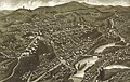
 St. Johnsbury, county seat of Caledonia County, Vt. (2675987880).jpg 2,000 × 1,398; 2.2 MB
-
 St. Johnsbury, county seat of Caledonia County, Vt. 1884. LOC 75696631.jpg 10,656 × 6,848; 12.84 MB
-
 St. Johnsbury, county seat of Caledonia County, Vt. 1884. LOC 75696631.tif 10,656 × 6,848; 208.78 MB
-
 St. Johnsbury, Vt. 1884 LCCN2003654974.jpg 9,832 × 6,814; 10.5 MB


.jpg)
.jpg)


_(14766888872).jpg)
_1884.jpg)


.jpg)

