Category:1884 maps of North Carolina
States of the United States: California · Connecticut · Delaware · Florida · Georgia · Idaho · Illinois · Indiana · Iowa · Kansas · Kentucky · Louisiana · Maine · Massachusetts · Michigan · Minnesota · Missouri · Montana · New Hampshire · New Jersey · New York · North Carolina · North Dakota · Ohio · Oregon · Pennsylvania · South Carolina · South Dakota · Tennessee · Texas · Utah · Vermont · Virginia · Washington · West Virginia · Wisconsin · Wyoming – Washington, D.C.
| 1884 1885 1887 1888 → |
Media in category "1884 maps of North Carolina"
The following 5 files are in this category, out of 5 total.
-
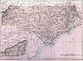 EB9 North Carolina.jpg 3,759 × 2,744; 2.12 MB
-

-
 Sanborn Fire Insurance Map from Tarboro, Edgecombe County, North Carolina. LOC sanborn06500 001.tif 6,450 × 7,650; 141.17 MB
-

-
 Sanborn Fire Insurance Map from Wilson, Wilson County, North Carolina. LOC sanborn06519 001.tif 6,450 × 7,650; 141.17 MB


