Category:1887 maps of Indiana
States of the United States: California · Connecticut · Florida · Georgia · Illinois · Indiana · Iowa · Kansas · Louisiana · Maine · Massachusetts · Michigan · Minnesota · Mississippi · Missouri · New Hampshire · New Jersey · New York · North Carolina · Ohio · Pennsylvania · South Dakota · Tennessee · Texas · Utah · Vermont · Virginia · Washington · Wisconsin · Wyoming
| ← 1880 1882 1883 1884 1885 1886 1887 1888 1889 → |
Subcategories
This category has the following 11 subcategories, out of 11 total.
S
Media in category "1887 maps of Indiana"
The following 8 files are in this category, out of 8 total.
-
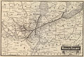 1887 Wabash map only.jpg 2,803 × 1,924; 1.51 MB
-
 Sanborn Fire Insurance Map from Rockville, Parke County, Indiana. LOC sanborn02485 002-1.jpg 6,450 × 7,650; 3.47 MB
-
 Sanborn Fire Insurance Map from Rockville, Parke County, Indiana. LOC sanborn02485 002-1.tif 6,450 × 7,650; 141.17 MB
-
 Sanborn Fire Insurance Map from Rockville, Parke County, Indiana. LOC sanborn02485 002-2.jpg 6,450 × 7,650; 3.47 MB
-
 Sanborn Fire Insurance Map from Rockville, Parke County, Indiana. LOC sanborn02485 002-2.tif 6,450 × 7,650; 141.17 MB
-

-

-
 Sanborn Fire Insurance Map from Williamsport, Warren County, Indiana. LOC sanborn02541 001.tif 6,450 × 7,650; 141.17 MB


