Category:18th-century maps of Guinea
Countries of Africa: Algeria · Angola · Benin · Cameroon · Cape Verde · Chad · Democratic Republic of the Congo · Republic of the Congo · Djibouti · Egypt‡ · Equatorial Guinea · Eritrea · Ethiopia · The Gambia · Ghana · Guinea · Ivory Coast · Libya · Madagascar · Mauritania · Morocco · Mozambique · Senegal · Sierra Leone · Somalia · South Africa · Sudan · Tanzania · Tunisia
Other areas: Madeira · Western Sahara
‡: partly located in Africa
Other areas: Madeira · Western Sahara
‡: partly located in Africa
Media in category "18th-century maps of Guinea"
The following 4 files are in this category, out of 4 total.
-
-
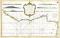
 A large chart of the North coast of Guinea - btv1b53153432q.jpg 6,670 × 5,408; 5.26 MB
-

-
 Rigobert-Bonne-Atlas-de-toutes-les-parties-connues-du-globe-terrestre MG 9990.tif 5,073 × 3,439; 49.95 MB


