Category:18th-century maps of Libya
Countries of Africa: Algeria · Angola · Benin · Cameroon · Cape Verde · Chad · Democratic Republic of the Congo · Republic of the Congo · Djibouti · Egypt‡ · Equatorial Guinea · Eritrea · Ethiopia · The Gambia · Ghana · Guinea · Ivory Coast · Libya · Madagascar · Mauritania · Morocco · Mozambique · Senegal · Sierra Leone · Somalia · South Africa · Sudan · Tanzania · Tunisia
Other areas: Madeira · Western Sahara
‡: partly located in Africa
Other areas: Madeira · Western Sahara
‡: partly located in Africa
Subcategories
This category has the following 7 subcategories, out of 7 total.
- 1740s maps of Libya (4 F)
- 1780s maps of Libya (2 F)
Media in category "18th-century maps of Libya"
The following 20 files are in this category, out of 20 total.
-

-

-

-
-

-
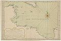
 Carte des côtes de Barbarie d'Alexandrie jusqu'à Mezorata - btv1b532354574.jpg 4,140 × 2,904; 1.02 MB
-
 Carte des côtes de Barbarie d'Alexandrie jusqu'à Tripoli - btv1b53235458k.jpg 8,134 × 3,218; 2.6 MB
-
 Carte des côtes de Barbarie, du cap Razat jusqu'à Tajoni - btv1b532354591.jpg 4,516 × 3,100; 1.68 MB
-

-
 Carte du cap Mesurat au fort anglais - btv1b53235470t.jpg 7,996 × 4,094; 3.02 MB
-

-
 Côte de Barbarie, depuis le cap Mesurat à l'île de la Bombe - btv1b532354646.jpg 6,980 × 3,110; 2.43 MB
-
 Côte de Barbarie, depuis le cap Razat jusqu'à Alexandrie - btv1b53235461v.jpg 7,084 × 2,936; 1.88 MB
-
 Côte de Barbarie, depuis le cap Rohat jusqu'au cap Brulo - btv1b532354629.jpg 7,342 × 3,116; 1.97 MB
-
 Côte de Barbarie, depuis Ras-al-sem à Alexandrie - btv1b53235463r.jpg 7,904 × 3,074; 1.97 MB
-
 Imperium Turcicum in Europa, Asia et Africa Regiones Propias, Tributaias Clientelares.jpg 11,372 × 8,819; 17.5 MB
-
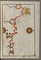 Piri Reis - Map of the Coast of Tripoli - Walters W658286B - Full Page.jpg 1,227 × 1,799; 2.72 MB
-
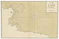
 Piri Reis - Map of the Libyan Coast as Far as Benghazi - Walters W658293A - Full Page.jpg 1,214 × 1,799; 2.67 MB
-
-


.jpg)
r_de_la_Marine_-_btv1b532354680.jpg)


