Category:18th-century maps of Tunisia
Countries of Africa: Algeria · Angola · Benin · Cameroon · Cape Verde · Chad · Democratic Republic of the Congo · Republic of the Congo · Djibouti · Egypt‡ · Equatorial Guinea · Eritrea · Ethiopia · The Gambia · Ghana · Guinea · Ivory Coast · Libya · Madagascar · Mauritania · Morocco · Mozambique · Senegal · Sierra Leone · Somalia · South Africa · Sudan · Tanzania · Tunisia
Other areas: Canary Islands · Madeira · Western Sahara
‡: partly located in Africa
Other areas: Canary Islands · Madeira · Western Sahara
‡: partly located in Africa
Subcategories
This category has the following 7 subcategories, out of 7 total.
- 1730s maps of Tunisia (11 F)
- 1780s maps of Tunisia (9 F)
Media in category "18th-century maps of Tunisia"
The following 68 files are in this category, out of 68 total.
-
 Aphrodisium demolita a Carolo V Imp. - btv1b8494779k.jpg 9,425 × 4,014; 4.41 MB
-
 Carte de la barbarie.png 1,669 × 777; 2.44 MB
-

-
-
-
 Vüe de la ville de Sousse en Barbarie - btv1b53237553d (1 of 2).jpg 6,565 × 4,834; 4.83 MB
-
 Vüe de la ville et rade de Sousse en Barbarie - Le Moyne - btv1b53237552z (1 of 2).jpg 6,133 × 4,596; 4.29 MB
-
 Tabarka plan 1770.jpg 1,000 × 1,259; 139 KB
-
 Ca. 1770 view of Tripoli Harbor.jpg 12,169 × 8,088; 19.42 MB
-

-

-

-
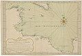
 Carte de Tunis et Golfe de Tunis - 1760.jpg 400 × 306; 23 KB
-
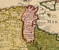
 Carte de Tunisie - 1760.jpg 512 × 712; 136 KB
-
 Carte des côtes algérienne et tunisienne du cap Bugaronie au cap Negro - btv1b532376117.jpg 10,404 × 8,002; 11.36 MB
-

-

-

-

-

-

-
 Carte des îles de la Galite.jpg 3,040 × 2,047; 2.93 MB
-

-
 Carte du cap Afrique à l'île de Djerba - par Mr de Chabert - btv1b53235469f.jpg 3,980 × 5,894; 2.19 MB
-

-

-
 Coste de Barbarie - Giacomo Alagna - btv1b53236714m.jpg 12,887 × 4,898; 9.68 MB
-

-

-
 Côte de Monestier dans la rade - btv1b53237547s.jpg 7,064 × 5,087; 5.48 MB
-
 Côtes de Barbarie, depuis Bizerte jusqu'à la pointe de Tarcu - btv1b532375665.jpg 6,328 × 4,121; 3.89 MB
-
 Côtes de Barbarie, depuis Bizerte jusqu'à la pointe de Tarcu - btv1b53237567m.jpg 6,283 × 4,229; 3.81 MB
-
 Côtes de Barbarie, depuis Bizerte jusqu'à la pointe de Tarcu - btv1b532375682.jpg 6,317 × 4,370; 4.02 MB
-
 Côtes de Barbarie, depuis Bougie jusqu'à Bizerte - btv1b53237569h (1 of 2).jpg 10,146 × 3,838; 5.78 MB
-
 Golfe de Tunis - Roux - 1764.jpg 2,900 × 2,035; 1.5 MB
-
 Guillaume Delisle Tunis 1707.jpg 1,543 × 1,315; 956 KB
-
 Ile de la Galite - btv1b53237603q.jpg 6,140 × 4,364; 3.38 MB
-

-
 Les côtes de Barbarie - du cap Bon jusqu'à Bougie - btv1b53242275k (1 of 2).jpg 33,232 × 5,533; 21.15 MB
-
 Nova planta dell Isola di Tabarca - btv1b53237540n.jpg 19,463 × 7,606; 21.47 MB
-
 Nuova pianta dell'isola di Tabarca - btv1b53242306h.jpg 12,686 × 4,566; 5.36 MB
-
 Nuova planta dell' Isola di Tabarca - btv1b53237599r.jpg 6,097 × 7,912; 7.03 MB
-
 Plan de l'isle de Tabarque à la coste de Barbarie - (Bellin) - btv1b8595381t.jpg 3,791 × 4,491; 2.38 MB
-

-

-
-
 Plan de la côte et Seches de Barbarie, depuis Zerbi jusqu'à Suza... - btv1b53237570w.jpg 8,687 × 6,651; 7.73 MB
-
 Plan de port Farine - (Bellin) - btv1b8595377x.jpg 3,854 × 4,560; 2.41 MB
-
 Plan des forts et canal de La Goulette - (Bellin) ; Croisey sc. - btv1b85953738.jpg 3,757 × 4,413; 2.55 MB
-
 Plan du cap Nègre en Barbarie - btv1b532376045.jpg 6,614 × 8,862; 8.63 MB
-
 Plan du cap Nègre en Barbarie - btv1b53237605m.jpg 5,971 × 8,273; 5.32 MB
-

-
 Plan et perspective de Tabarque - btv1b532375989.jpg 8,467 × 5,598; 7.04 MB
-

-

-
 Plan géométrique de l'île de la Galite - btv1b532376028.jpg 5,546 × 4,246; 3.27 MB
-
 Port Farine - btv1b53237583n.jpg 6,146 × 4,405; 3.63 MB
-
 Rade de Monestier - btv1b532375737.jpg 7,231 × 5,509; 5.1 MB
-
 Routes et sondes entre Zerbi et le Cap Poule - btv1b53237563t.jpg 9,215 × 9,520; 12.84 MB
-

-

-
 Tunesi - btv1b8595369c.jpg 4,960 × 4,397; 4.13 MB
-
 Tunis - 1760.jpg 3,000 × 2,299; 1.02 MB
-
 Tunis - Bellin - 1764.jpg 2,201 × 2,808; 1.27 MB
-
 Veue de l'Isle de Tabarqua - btv1b84937605.jpg 3,923 × 5,590; 2.79 MB
-
 Veue du Cap Nègre - situé à la côte de Barbarie Royaume de Thunis - btv1b53237537c (1 of 2).jpg 8,502 × 10,905; 11.97 MB
-
 Veüe du Capnegre - btv1b53237556r.jpg 3,704 × 5,552; 3.05 MB
-
 Veüe du moüillage de la Goulette - btv1b532375559.jpg 8,193 × 5,950; 6.88 MB


r_de_la_Marine_-_btv1b532354680.jpg)

.jpg)
.jpg)


.jpg)

.jpg)


.jpg)


_-_btv1b8595381t.jpg)


_-_btv1b8595377x.jpg)
_;_Croisey_sc._-_btv1b85953738.jpg)


.jpg)

.jpg)
.jpg)


.jpg)


.jpg)
.jpg)
.jpg)
.jpg)
.jpg)