Category:18th-century maps of the Canary Islands
Countries of Africa: Algeria · Angola · Benin · Cameroon · Cape Verde · Chad · Democratic Republic of the Congo · Republic of the Congo · Djibouti · Egypt‡ · Equatorial Guinea · Eritrea · Ethiopia · The Gambia · Ghana · Guinea · Ivory Coast · Libya · Madagascar · Mauritania · Morocco · Mozambique · Senegal · Sierra Leone · Somalia · South Africa · Sudan · Tanzania · Tunisia
Other areas: Canary Islands · Madeira · Western Sahara
‡: partly located in Africa
Other areas: Canary Islands · Madeira · Western Sahara
‡: partly located in Africa
Media in category "18th-century maps of the Canary Islands"
The following 48 files are in this category, out of 48 total.
-
 Ar.Gbis-T.4-C.1 2 (2).jpg 8,425 × 6,062; 8.44 MB
-
 Carta reducida de las islas de Canaria - T. Lopez - btv1b53177502v.jpg 10,740 × 5,248; 6.43 MB
-

-

-
-
-

-
 A chart of the Canarie & Madera Islands - btv1b531688523.jpg 6,498 × 5,320; 5.84 MB
-
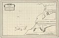
 A chart of the Canarie and Madera Islands (ca. 1702-1707).jpg 760 × 615; 97 KB
-
 A chart of the CANARIE and MADERA Islands NYPL1640659.tiff 7,230 × 5,428; 112.28 MB
-

-

-

-

-
 A chart of the coast of BARBARIA with the Western, Canaria and Cape de Verd, Isles NYPL1640676.tiff 7,230 × 5,428; 112.28 MB
-

-
 A chart of the Maderas and Canary Islands - G. Glas - btv1b531685860.jpg 6,017 × 7,752; 7.2 MB
-
 A chart of the Maderas and Canary Islands - G. Glas - btv1b53177457s.jpg 7,638 × 11,490; 8.92 MB
-
 Archipelagus atlanticus cum suis insulis Canariis, Hesperidibus et Azoribus (5960813003).jpg 2,000 × 1,245; 2.27 MB
-

-

-
-
 Carte des isles Canaries - (Bellin) - btv1b8595818s.jpg 3,826 × 3,065; 1.69 MB
-

-

-

-

-

-
 Histoire des deux Indes-Atlas-d20-C03-Canaries.png 2,233 × 1,703; 984 KB
-
 Iles Canaries... - Herisson, delt - btv1b8439311h.jpg 6,599 × 4,621; 3.6 MB
-

-
 Isla de la gran Canaria - por Don Tomas López... - btv1b53227008c (1 of 2).jpg 7,384 × 5,683; 4.37 MB
-

-
 Map - Special Collections University of Amsterdam - OTM- HB-KZL 33.20.07.tif 8,008 × 6,864; 157.26 MB
-
 Map of Tenerife.jpg 800 × 640; 115 KB
-
 Mapa de la isla de Fuerteventura - por Don Tomas López... - btv1b53227009t (1 of 2).jpg 7,438 × 5,696; 4.64 MB
-

-

-
 Mapa de la isla de Lanzarote - por Don Tomas López... - btv1b532270106 (1 of 2).jpg 7,508 × 5,694; 4.3 MB
-
 Mapa Gran Canaria Siglo xviii.jpg 718 × 643; 593 KB
-
 Mapa Plaza España 01l.jpg 873 × 565; 280 KB
-
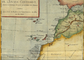
 Marokko Küste 003.jpg 2,684 × 2,361; 464 KB
-
-

-
 Plano de la ciudad de Las Palmas de 1792 por Luis Marquell.jpg 3,116 × 2,288; 463 KB
-
 Rigobert-Bonne-Atlas-de-toutes-les-parties-connues-du-globe-terrestre MG 9989.tif 3,499 × 5,219; 52.28 MB
-
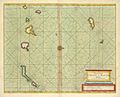
 Sankt-Brendan-Insel und Kanarische Inseln 1707.jpg 2,059 × 677; 769 KB
-
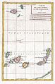
 The Canary Islands, with Madeira and Porto Santo (1780).jpg 408 × 600; 42 KB
.jpg)

.jpg)
.jpg)


.jpg)

.jpg)
.jpg)


_GEO._GLAS_in_1759_%26_1760,_and_those_of_Mon(sieur)_DE..._-_btv1b59664365_(1_of_2).jpg)
_-_btv1b85957972.jpg)


.jpg)

_Armada..._-_btv1b5966449s.jpg)

_-_btv1b8595818s.jpg)

.jpg)
.jpg)
_et_les_Isles_Canaries,_seconde_feuille_Depuis..._-_btv1b10678512f_(1_of_2).jpg)


.jpg)
.jpg)

.jpg)
.jpg)

.jpg)


.jpg)

.jpg)