Category:Maps of Tunisia
Countries of Africa: Algeria · Angola · Benin · Botswana · Burkina Faso · Burundi · Cameroon · Cape Verde · Central African Republic · Chad · Comoros · Democratic Republic of the Congo · Republic of the Congo · Djibouti · Egypt‡ · Equatorial Guinea · Eritrea · Eswatini · Ethiopia · Gabon · The Gambia · Ghana · Guinea · Guinea-Bissau · Ivory Coast · Kenya · Lesotho · Liberia · Libya · Madagascar · Malawi · Mali · Mauritania · Mauritius · Morocco · Mozambique · Namibia · Niger · Nigeria · Rwanda · São Tomé and Príncipe · Senegal · Seychelles · Sierra Leone · Somalia · South Africa · South Sudan · Sudan · Tanzania · Togo · Tunisia · Uganda · Zambia · Zimbabwe
Limited recognition: Ambazonia · Azawad · Puntland · Sahrawi Arab Democratic Republic · Somaliland – Other areas: Canary Islands · Ceuta · Madeira · Mayotte · Melilla · Réunion · Saint Helena, Ascension and Tristan da Cunha · Scattered Islands in the Indian Ocean · Western Sahara
‡: partly located in Africa
Use the appropriate category for maps showing all or a large part of Tunisia. See subcategories for smaller areas:
| If the map shows | Category to use |
|---|---|
| Tunisia on a recently created map | Category:Maps of Tunisia or its subcategories |
| Tunisia on a map created more than 70 years ago | Category:Old maps of Tunisia or its subcategories |
| the history of Tunisia on a recently created map | Category:Maps of the history of Tunisia or its subcategories |
| the history of Tunisia on a map created more than 70 years ago | Category:Old maps of the history of Tunisia or its subcategories |
Wikimedia category | |||||
| Upload media | |||||
| Instance of | |||||
|---|---|---|---|---|---|
| Category combines topics | |||||
 | |||||
Subcategories
This category has the following 30 subcategories, out of 30 total.
- Blank maps of Tunisia (20 F)
A
B
- Bilateral maps of Tunisia (69 F)
C
F
G
H
I
J
L
- Location maps of Tunisia (3 F)
M
O
P
S
T
Pages in category "Maps of Tunisia"
This category contains only the following page.
Media in category "Maps of Tunisia"
The following 42 files are in this category, out of 42 total.
-
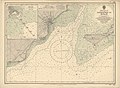
 Admiralty Chart No 1159 Sousse to Mahdia, Published 1958.jpg 11,031 × 8,335; 11.9 MB
-
 Admiralty Chart No 1162 Approaches to Sfax, Published 1957.jpg 8,456 × 6,195; 10.41 MB
-
 Admiralty Chart No 2121 Cap de Fer to Iles Cani, Published 1963.jpg 16,196 × 11,041; 23.91 MB
-
 Admiralty Chart No 2122 Bizerte to Capo San Marco, Published 1963.jpg 16,334 × 11,152; 47.18 MB
-
 Admiralty Chart No 3327 Kélibia to Tripoli, Published 1958.jpg 8,358 × 12,230; 21.4 MB
-
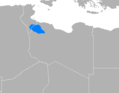 Amazigh Nafusi Location.png 560 × 436; 11 KB
-
 Borj Gourbata Map.png 248 × 470; 36 KB
-
 Carte de Tunisie au mur, Musée Bourguiba, Monastir 2013.jpg 3,894 × 2,970; 11.06 MB
-
 Carte Kerkennah.png 800 × 534; 511 KB
-
 Diplomatic missions of Tunisia.PNG 1,425 × 625; 64 KB
-
 ECDM 20160907 Migration.pdf 1,754 × 1,239; 1,012 KB
-
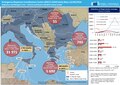 ECDM 20160922 Migration RefugeeCrisis.pdf 1,754 × 1,239; 1,006 KB
-
 Ecole primaire Alhawamed Sidi Bouzid WikiChallenge 2022 01.jpg 3,472 × 4,624; 3.28 MB
-
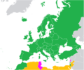 EurovisionParticipants.png 1,200 × 1,009; 292 KB
-
 FLII Tunisia.png 929 × 822; 151 KB
-
 Italia di marmo (3093248342).jpg 886 × 1,181; 1.1 MB
-
 Jdemmer.png 813 × 605; 924 KB
-
 Khniss Tunisia.jpg 492 × 1,078; 163 KB
-
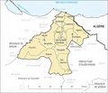
 Localisation Confédération des Ouerghemma.png 400 × 775; 944 KB
-
 Localisation Mogods.png 627 × 471; 113 KB
-
 LocMap of WH Site of Carthage.png 275 × 275; 3 KB
-
 Map of Kroussia by Ahmed Saidi (English Version).tif 2,082 × 1,103; 466 KB
-
 Map of Tunisia.gif 300 × 300; 4 KB
-
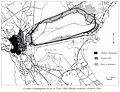
 Mareth Line Panel.jpg 3,072 × 2,304; 1.61 MB
-
 Oued miliane bassin versant.jpg 1,600 × 1,700; 93 KB
-
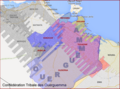 Ouerguemma.png 737 × 548; 934 KB
-
 Population density of Tunisia governorates.png 3,584 × 6,199; 739 KB
-
 Projet berges bahira.jpg 2,000 × 1,525; 355 KB
-
 Provenance mosaiques El Jem.jpg 2,304 × 3,072; 2.85 MB
-
 Province de Berkane.png 1,600 × 1,370; 807 KB
-
 Tunesische-WM-Platzierungen.PNG 1,425 × 625; 39 KB
-
 Tunez parques nacionales.jpg 2,000 × 4,333; 673 KB
-
 Tunisia - DPLA - 35e1bb529df536145ea1785505a0ca72 (page 1).jpg 2,558 × 3,268; 5.84 MB
-
 Tunisia - DPLA - 35e1bb529df536145ea1785505a0ca72 (page 2).jpg 2,554 × 3,282; 5.72 MB
-
 Tunisia Population Density, 2000 (5457019725).jpg 2,496 × 3,216; 591 KB
-
 Tunisia Population Density, 2000 (6172450206).jpg 2,328 × 3,160; 571 KB
-
 Tunisia364.jpg 2,048 × 1,536; 780 KB
-
 Tunisian Professional league 1 map.png 466 × 960; 111 KB
-
 Txu-oclc-6949452-ni32-8.jpg 5,000 × 3,792; 4.36 MB
-
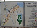
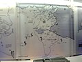
 Une carte touristique à Ksar Hadada.jpg 3,264 × 2,448; 1.47 MB
-
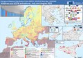 Wildfires RfAs July Aug2023 DM(4).pdf 1,754 × 1,239; 1.29 MB
-
 Зоопарк Фригия, Тунис, указатель чё где - panoramio.jpg 3,264 × 2,448; 2.19 MB


.jpg)


.jpg)
.jpg)
.jpg)
.jpg)


