Category:Maps of Ivory Coast
Countries of Africa: Algeria · Angola · Benin · Botswana · Burkina Faso · Burundi · Cameroon · Cape Verde · Central African Republic · Chad · Comoros · Democratic Republic of the Congo · Republic of the Congo · Djibouti · Egypt‡ · Equatorial Guinea · Eritrea · Eswatini · Ethiopia · Gabon · The Gambia · Ghana · Guinea · Guinea-Bissau · Ivory Coast · Kenya · Lesotho · Liberia · Libya · Madagascar · Malawi · Mali · Mauritania · Mauritius · Morocco · Mozambique · Namibia · Niger · Nigeria · Rwanda · São Tomé and Príncipe · Senegal · Seychelles · Sierra Leone · Somalia · South Africa · South Sudan · Sudan · Tanzania · Togo · Tunisia · Uganda · Zambia · Zimbabwe
Limited recognition: Ambazonia · Azawad · Puntland · Sahrawi Arab Democratic Republic · Somaliland – Other areas: Canary Islands · Ceuta · Madeira · Mayotte · Melilla · Réunion · Saint Helena, Ascension and Tristan da Cunha · Scattered Islands in the Indian Ocean · Western Sahara
‡: partly located in Africa
日本語: コートジボワール共和国の地図に関するカテゴリ。
Wikimedia category | |||||
| Upload media | |||||
| Instance of | |||||
|---|---|---|---|---|---|
| Category combines topics | |||||
 | |||||
Subcategories
This category has the following 27 subcategories, out of 27 total.
- Blank maps of Ivory Coast (6 F)
- Military maps of Ivory Coast (1 F)
A
- Maps of Abidjan (18 F)
B
- Bilateral maps of Ivory Coast (44 F)
C
D
F
H
K
- Maps of Korhogo (13 F)
L
- Location maps of Ivory Coast (4 F)
M
- Maps of Bouaké (1 F)
O
P
R
S
- Sports maps of Ivory Coast (3 F)
T
Pages in category "Maps of Ivory Coast"
The following 2 pages are in this category, out of 2 total.
Media in category "Maps of Ivory Coast"
The following 53 files are in this category, out of 53 total.
-
-
 20230530 West & Central Africa Complex Crisis(1).pdf 1,754 × 1,239; 728 KB
-
 20230530 West & Central Africa Complex Crisis(1).png 3,509 × 2,482; 10.26 MB
-
-
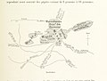
 Carte Katiali.png 850 × 1,159; 44 KB
-
 Carterégionci.png 951 × 1,054; 283 KB
-
 Cercocebus atys atys area.png 640 × 395; 18 KB
-
 Cote d'Ivoire (Ivory Coast) - DPLA - 196d39b2105f790f61cb3a44b6deb662.jpg 2,558 × 3,276; 5.11 MB
-
 Cote d'Ivoire.png 499 × 552; 15 KB
-
 Cote'divoire Transportation Map.jpg 2,000 × 2,583; 1.61 MB
-
 CotedIvoire Hydrogeology3.png 831 × 916; 21 KB
-
 Côte d'Ivoire 1889.jpg 816 × 1,038; 587 KB
-
 Côte d'Ivoire Regions.png 440 × 461; 164 KB
-
 Côte d'Ivoire, administrative divisions - ja - colored.svg 1,328 × 1,339; 649 KB
-
 Côte d'Ivoire, administrative divisions - oc - colored.svg 1,328 × 1,339; 649 KB
-
 Côte d'Ivoire. LOC 2004633023.jpg 2,485 × 3,215; 1.02 MB
-
 Côte d'Ivoire. LOC 2004633023.tif 2,485 × 3,215; 22.86 MB
-
 Côte d'Ivoire. LOC 2005631073.tif 2,526 × 3,090; 22.33 MB
-
 Districts of Côte d'Ivoire (Numbered).png 2,000 × 2,197; 396 KB
-
 Districts of Côte d'Ivoire.png 2,000 × 2,197; 382 KB
-
 ECHO Ivory Coast Editable A4 Landscape.pdf 1,754 × 1,239; 629 KB
-
 ECHO Ivory Coast Editable A4 Landscape.png 1,123 × 794; 366 KB
-
 ECHO West Africa Editable A4 Landscape.pdf 1,754 × 1,239; 571 KB
-
 FLII IvoryCoast.png 870 × 818; 760 KB
-
 Itinéraire Mission Thomann 1902 de Sassandra à Séguéla, Côte d'Ivoire.jpg 2,465 × 3,239; 4.19 MB
-
 Ivory Coast - DPLA - 5c0c794069dd63aee2a927a5a73401e2 (page 1).jpg 2,554 × 3,276; 5.91 MB
-
 Ivory Coast - DPLA - 5c0c794069dd63aee2a927a5a73401e2 (page 2).jpg 2,556 × 3,278; 5.63 MB
-
 Ivory Coast - DPLA - dc39c9a9edc79b2f6a242f57ba770880 (page 1).jpg 2,554 × 3,276; 5.73 MB
-
 Ivory Coast - DPLA - dc39c9a9edc79b2f6a242f57ba770880 (page 2).jpg 2,554 × 3,272; 5.46 MB
-
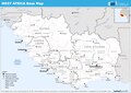
 Ivory Coast Base Map.png 1,113 × 707; 411 KB
-
 Ivory Coast regions april 2014.svg 365 × 401; 39 KB
-
 Ivory Coast. LOC 93685668.jpg 3,462 × 4,441; 1.59 MB
-
 Ivory Coast. LOC 93685668.tif 3,462 × 4,441; 43.99 MB
-
 Ivory cost before 2011.png 399 × 425; 42 KB
-
 Ivory cost map.png 264 × 296; 35 KB
-
 La carte de Côte d'Ivoire au format SVG.svg 280 × 295; 1.35 MB
-
 Laguneébrié.png 394 × 184; 27 KB
-
 LanguagesCoteDIvoire.png 1,381 × 1,614; 343 KB
-
 Mano River Union.png 650 × 400; 14 KB
-
 Mapa da Costa do Marfim (OCHA).svg 254 × 254; 338 KB
-
 Mon pays.jpeg 91 × 96; 3 KB
-

-
 Parcs de Côte d'Ivoire.svg 843 × 862; 1.79 MB
-
 Ivory Coast March 2011 offensive map.jpg 2,366 × 2,911; 1.96 MB
-
 Ivory Coast March 2011 offensive map.png 2,366 × 2,911; 662 KB
-
 Regions and Autonomous Districts of Côte d'Ivoire (ZH).svg 758 × 794; 6.48 MB
-
 Sankarani river map.png 200 × 667; 59 KB
-
 Régions of Côte d'Ivoire (Numbered).png 357 × 348; 38 KB
-
 Txu-oclc-6595921-nc30-15 crop southwest.jpg 1,341 × 715; 1.36 MB
-
 Txu-oclc-6595921-nc30-15.jpg 5,000 × 3,785; 5.02 MB
-
 Un-cotedivoire.png 2,366 × 2,911; 1.91 MB
-
 UNOCI 2011 map.png 2,340 × 3,012; 1.56 MB
-
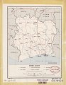
 مقاطعات ساحل العاج.svg 800 × 500; 46 KB
.jpg)
.png)
.jpg)


_-_DPLA_-_196d39b2105f790f61cb3a44b6deb662.jpg)


.png)


.jpg)
.jpg)
.jpg)
.jpg)


.svg)


.svg)
.png)


