Category:1916 maps of Illinois
States of the United States: California · Idaho · Illinois · Indiana · Iowa · Kentucky · Louisiana · Maine · Maryland · Massachusetts · Michigan · Minnesota · New Hampshire · New Jersey · New York · North Dakota · Pennsylvania · Rhode Island · South Dakota · Tennessee · Utah · Vermont · West Virginia · Wisconsin – Washington, D.C.
| ← 1910 1911 1912 1913 1914 1915 1916 1917 1918 1919 → |
Subcategories
This category has the following 4 subcategories, out of 4 total.
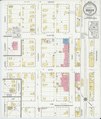
Media in category "1916 maps of Illinois"
The following 10 files are in this category, out of 10 total.
-
 Sanborn Fire Insurance Map from Benson, Woodford County, Illinois. LOC sanborn01732 001.jpg 6,450 × 7,650; 4.14 MB
-
 Sanborn Fire Insurance Map from Benson, Woodford County, Illinois. LOC sanborn01732 001.tif 6,450 × 7,650; 141.17 MB
-
 Sanborn Fire Insurance Map from Hull, Pike County, Illinois. LOC sanborn01932 001.jpg 6,450 × 7,650; 3.86 MB
-
 Sanborn Fire Insurance Map from Hull, Pike County, Illinois. LOC sanborn01932 001.tif 6,450 × 7,650; 141.17 MB
-

-

-

-
 Sanborn Fire Insurance Map from New Windsor, Mercer County, Illinois. LOC sanborn02049 002.tif 6,450 × 7,650; 141.17 MB
-

-
 Sanborn Fire Insurance Map from Stronghurst, Henderson County, Illinois. LOC sanborn02171 001.tif 6,450 × 7,650; 141.17 MB


