Category:1940s maps of Massachusetts
States of the United States: Alabama · Alaska · Arizona · Arkansas · California · Colorado · Connecticut · Delaware · Florida · Georgia · Hawaii · Idaho · Illinois · Indiana · Iowa · Kansas · Kentucky · Louisiana · Maine · Maryland · Massachusetts · Michigan · Minnesota · Mississippi · Missouri · Montana · Nebraska · Nevada · New Hampshire · New Jersey · New Mexico · New York · North Carolina · North Dakota · Ohio · Oklahoma · Oregon · Pennsylvania · Rhode Island · South Dakota · Tennessee · Texas · Utah · Vermont · Virginia · Washington · West Virginia · Wisconsin · Wyoming – Washington, D.C.
Puerto Rico
Puerto Rico
Subcategories
This category has only the following subcategory.
Media in category "1940s maps of Massachusetts"
The following 3 files are in this category, out of 3 total.
-
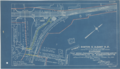 1944 Riverside station area blueprints.png 3,500 × 2,002; 11.47 MB
-
 Admiralty Chart No 2456 Nantucket Sound and Western Approaches, Published 1896, New Edition 1946.jpg 16,280 × 11,066; 54.86 MB
-


