Category:1960s maps of Massachusetts
States of the United States: Alabama · Alaska · Arizona · California · Colorado · Delaware · Florida · Georgia · Hawaii · Illinois · Louisiana · Maine · Massachusetts · Michigan · Mississippi · Nebraska · New Hampshire · New Jersey · New York · Ohio · Oklahoma · Oregon · Pennsylvania · Tennessee · Utah · Virginia · West Virginia – Washington, D.C.
Puerto Rico
Puerto Rico
Media in category "1960s maps of Massachusetts"
The following 6 files are in this category, out of 6 total.
-
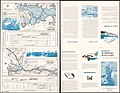
 Admiralty Chart No 1227 Portsmouth Harbour to Boston Harbour, Published 1960.jpg 11,125 × 16,257; 55.39 MB
-
 Concord River, Bedford, Massachusetts, flood plains. LOC gm69002562.jpg 6,663 × 5,163; 4.24 MB
-
 Concord River, Bedford, Massachusetts, flood plains. LOC gm69002562.tif 6,663 × 5,163; 98.42 MB
-
 Northern sector transit alternatives map from 1966 PMT.jpg 1,661 × 2,219; 245 KB
-
 Saugus Iron Works. LOC 75692105.jpg 5,910 × 3,438; 2.96 MB
-
 Saugus Iron Works. LOC 75692105.tif 5,910 × 3,438; 58.13 MB


