Category:2008 maps of the United States
Countries of Oceania: Australia
States of the United States: Alabama · Arizona · California · Florida · Iowa · Kentucky · Massachusetts · Michigan · New York · Pennsylvania · South Carolina · Texas · Utah · Wyoming – Washington, D.C.
Subcategories
This category has the following 16 subcategories, out of 16 total.
A
- 2008 maps of Arizona (1 F)
C
D
F
- 2008 maps of Florida (7 F)
I
K
M
- 2008 maps of Massachusetts (14 F)
- 2008 maps of Michigan (3 F)
N
P
S
- 2008 maps of South Carolina (4 F)
T
- 2008 maps of Texas (1 F)
U
- 2008 maps of Utah (2 F)
W
- 2008 maps of Wyoming (2 F)
Media in category "2008 maps of the United States"
The following 8 files are in this category, out of 8 total.
-
 2008 crop damage insurance filings.jpg 560 × 367; 198 KB
-
 Lebensraum der Spokane Indianer.png 1,256 × 1,058; 2.09 MB
-

-
 U.S. Military Installations Map.jpg 16,500 × 13,800; 52.36 MB
-
 United States electoral college, votes by state LOC 2008626928.jpg 15,420 × 12,039; 5.95 MB
-
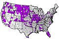
 US AIAN 2008 map.gif 575 × 425; 10 KB
-
 USChemicalWeaponsStockpiles082808.jpg 960 × 720; 100 KB
-
 Vs snelweg doden per snelweg genormaliseerd groene achtergrond.PNG 3,370 × 2,217; 447 KB


_-_fsbdev3_033146_(page_2_crop).jpg)


