Category:2010 maps of the United States
Countries of the Americas: Argentina · Bolivia · Canada · Haiti · Mexico · United States of America
Other areas: Puerto Rico
Other areas: Puerto Rico
States of the United States: Alabama · Alaska · Arizona · Arkansas · California · Colorado · Connecticut · Delaware · Florida · Georgia · Hawaii · Idaho · Illinois · Indiana · Iowa · Kansas · Kentucky · Louisiana · Maine · Maryland · Massachusetts · Michigan · Minnesota · Mississippi · Missouri · Montana · Nebraska · Nevada · New Hampshire · New Jersey · New Mexico · New York · North Carolina · North Dakota · Ohio · Oklahoma · Oregon · Pennsylvania · Rhode Island · South Carolina · South Dakota · Tennessee · Texas · Utah · Vermont · Virginia · Washington · West Virginia · Wisconsin · Wyoming – Washington, D.C.
Guam · Puerto Rico
Guam · Puerto Rico
Subcategories
This category has the following 55 subcategories, out of 55 total.
A
- 2010 maps of Alabama (8 F)
- 2010 maps of Alaska (3 F)
- 2010 maps of Arkansas (16 F)
C
- 2010 maps of Colorado (23 F)
- 2010 maps of Connecticut (6 F)
D
- 2010 maps of Delaware (1 F)
F
- 2010 maps of Florida (46 F)
G
- 2010 maps of Guam (1 F)
H
- 2010 maps of Hawaii (5 F)
I
- 2010 maps of Idaho (4 F)
- 2010 maps of Illinois (56 F)
- 2010 maps of Indiana (42 F)
K
- 2010 maps of Kansas (23 F)
- 2010 maps of Kentucky (20 F)
L
- 2010 maps of Louisiana (34 F)
M
- 2010 maps of Maine (9 F)
- 2010 maps of Maryland (16 F)
- 2010 maps of Massachusetts (23 F)
- 2010 maps of Michigan (44 F)
- 2010 maps of Minnesota (33 F)
- 2010 maps of Missouri (35 F)
- 2010 maps of Montana (21 F)
N
- 2010 maps of Nebraska (17 F)
- 2010 maps of Nevada (24 F)
- 2010 maps of New Hampshire (4 F)
- 2010 maps of New Jersey (24 F)
- 2010 maps of New Mexico (21 F)
- 2010 maps of North Carolina (42 F)
- 2010 maps of North Dakota (6 F)
O
- 2010 maps of Ohio (43 F)
- 2010 maps of Oregon (26 F)
P
- 2010 maps of Puerto Rico (15 F)
R
- 2010 maps of Rhode Island (2 F)
S
- 2010 maps of South Carolina (19 F)
- 2010 maps of South Dakota (6 F)
T
- 2010 maps of Tennessee (31 F)
- 2010 maps of Texas (121 F)
U
- 2010 maps of Utah (13 F)
V
- 2010 maps of Vermont (8 F)
- 2010 maps of Virginia (22 F)
W
- 2010 maps of Washington (state) (28 F)
- 2010 maps of West Virginia (18 F)
- 2010 maps of Wisconsin (35 F)
- 2010 maps of Wyoming (7 F)
Media in category "2010 maps of the United States"
The following 15 files are in this category, out of 15 total.
-
-
-
 2010 US rice production.svg 844 × 634; 1.91 MB
-
 2010ElectoralCartogramGott.png 900 × 580; 40 KB
-
 Location map Washington, D.C. east.png 767 × 731; 644 KB
-
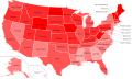
 Map of states showing number of gun murders in 2010.svg 1,000 × 630; 73 KB
-
 Mormons 2010.png 8,450 × 12,317; 2.87 MB
-
 Percent Hispanic or Latino (of any race).png 712 × 473; 90 KB
-
 Plurality Religious Denomination by U.S. State (ARDA).svg 1,920 × 1,080; 265 KB
-
 Population Change by Percentage - 2010 US Census.png 5,285 × 3,762; 1.17 MB
-
 US coal production by coal-producing region, 2010.png 459 × 307; 95 KB
-
 USurban2010.png 506 × 313; 6 KB
-
 WBR-1795.png 1,642 × 1,389; 1.97 MB
-
 White American by state in the USA in 2010.svg 981 × 589; 482 KB
-
 Whole US June 12 (4624746773).jpg 5,597 × 2,907; 2.13 MB


.png)
.svg)


.jpg)