Category:2019 maps of the United States
Subcategories
This category has the following 6 subcategories, out of 6 total.
C
- 2019 maps of California (7 F)
M
- 2019 maps of Massachusetts (1 F)
N
P
W
- 2019 maps of West Virginia (1 F)
Media in category "2019 maps of the United States"
The following 14 files are in this category, out of 14 total.
-
 2019 United States tornado touchdowns.png 1,018 × 710; 35 KB
-
 Carte tendences électorales us.png 5,175 × 3,762; 822 KB
-
 Election 2020 State Polls Aggregate Dem Can-Trump.png 5,175 × 3,762; 856 KB
-
 Female senators.svg 512 × 317; 58 KB
-
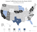 Human Trafficking in the United States.gif 1,454 × 1,274; 61 KB
-
 Life expectancy map of USA 2019 with names.png 5,000 × 3,500; 1.11 MB
-
 Life expectancy map of USA 2019.png 5,000 × 3,500; 1.01 MB
-
 Most common ancestry in the United States by county.png 3,060 × 1,348; 359 KB
-
 NRHP Colorado Map.svg 990 × 765; 8.22 MB
-
 Spanish spoken at home in the United States 2019.svg 959 × 593; 66 KB
-
 SpeedwayMap.svg 959 × 593; 68 KB
-
 U S states districts and territories in 2019 in which non Hispanic whites are.png 5,285 × 3,762; 1.36 MB
-
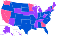
 Women in the United States Senate Map by Party.svg 512 × 663; 32 KB
-
 Women in the United States Senate Map.svg 959 × 593; 32 KB


