Category:2013 maps of Germany
Countries of Europe: Albania · Austria · Belarus · Bulgaria · Croatia · Denmark · Finland · Germany · Greece · Hungary · Iceland · Republic of Ireland · Italy · Kazakhstan‡ · Lithuania · Moldova · Netherlands‡ · Norway · Poland · Slovakia · Slovenia · Spain‡ · Sweden · Switzerland · Turkey‡ · Ukraine · United Kingdom
‡: partly located in Europe
‡: partly located in Europe
Federal states of Germany:
Subcategories
This category has the following 9 subcategories, out of 9 total.
'
- 2013 maps of Hamburg (6 F)
- 2013 maps of Hesse (4 F)
- 2013 maps of Saarland (3 F)
- 2013 maps of Saxony (1 F)
- 2013 maps of Saxony-Anhalt (2 F)
B
Media in category "2013 maps of Germany"
The following 12 files are in this category, out of 12 total.
-
 Bevölkerungsentwicklung abzüglich der Geburtenbilanz 2010-2013.svg 946 × 1,253; 647 KB
-
 Bevölkerungsentwicklung abzüglich der Geburtenbilanz 2012-2013.svg 946 × 1,253; 647 KB
-
 Bevölkerungsentwicklung Kreisebene 2010-2013.svg 946 × 1,253; 702 KB
-
 Bevölkerungsentwicklung Kreisebene 2012-2013.svg 946 × 1,253; 702 KB
-
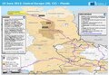
 ECDM 20130610 CentralEurope Floods.jpg 1,040 × 720; 193 KB
-
 ECDM 20130610 CentralEurope Floods.pdf 1,625 × 1,125, 2 pages; 1.28 MB
-
 ECDM 20131205 NorthernEurope SevereWeather.pdf 1,625 × 1,125; 816 KB
-
 ECDM 20131206 NorthernEurope SevereWeather.pdf 1,625 × 1,125; 716 KB
-
 Geburtenbilanz Kreisebene 2013.svg 946 × 1,253; 647 KB
-
 Geburtenrate Deutschland 2013.svg 946 × 1,253; 647 KB
-
 Germany - Location Map (2013) - DEU - UNOCHA.svg 250 × 250; 1,015 KB
-
 Gestorbene Kreisebene 2013.svg 946 × 1,253; 647 KB


_-_DEU_-_UNOCHA.svg)
