Category:2018 maps of Germany
Federal states of Germany:
Subcategories
This category has the following 8 subcategories, out of 8 total.
'
- 2018 maps of Bavaria (3 F)
- 2018 maps of Hamburg (4 F)
- 2018 maps of Hesse (1 F)
- 2018 maps of Lower Saxony (1 F)
- 2018 maps of Saarland (1 F)
Media in category "2018 maps of Germany"
The following 24 files are in this category, out of 24 total.
-
 Bevölkerungsentwicklung abzüglich der Geburtenbilanz 2015-2018.svg 946 × 1,253; 647 KB
-
 Bevölkerungsentwicklung abzüglich der Geburtenbilanz 2017-2018.svg 946 × 1,253; 647 KB
-
 Bevölkerungsentwicklung Kreisebene 2015-2018.svg 946 × 1,253; 703 KB
-
 Bevölkerungsentwicklung Kreisebene 2017-2018.svg 946 × 1,253; 703 KB
-
 Die AFD in deutschen Landtagen (Stand November 2018).png 4,235 × 4,505; 795 KB
-
 Die Landtagswahlergebnisse der Linken (Stand November 2018).png 4,235 × 4,505; 808 KB
-
 Die Landtagswahlergebnisse von Bündnis 90 Die Grünen (Stand November 2018).png 4,235 × 4,505; 809 KB
-
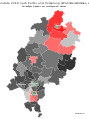 Direktmandate der Landtagswahl Hessen 2018 Graustufen.svg 560 × 750; 221 KB
-
 Direktmandate der Landtagswahl Hessen 2018.svg 560 × 750; 221 KB
-
 Geburtenbilanz Kreisebene 2018.svg 946 × 1,253; 647 KB
-
 Geburtenrate Deutschland 2018.svg 946 × 1,253; 647 KB
-
 German states by GDP per capita, 2018.jpg 4,235 × 4,505; 1.66 MB
-
 German states by GRP in 2018.jpg 4,235 × 4,505; 1.49 MB
-
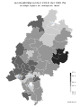
 German states by HDI (2018).svg 512 × 624; 128 KB
-
 Gestorbene Kreisebene 2018.svg 946 × 1,253; 647 KB
-
 Landesstimmen 2018 der AfD (%).svg 560 × 750; 221 KB
-
 Landesstimmen 2018 der CDU (%) Graustufen.svg 560 × 750; 221 KB
-
 Landesstimmen 2018 der CDU (%).svg 560 × 750; 221 KB
-
 Landesstimmen 2018 der FDP (%).svg 560 × 750; 221 KB
-
 Landesstimmen 2018 der Grünen (%).svg 560 × 750; 221 KB
-
 Landesstimmen 2018 der Linken (%).svg 560 × 750; 221 KB
-
 Landesstimmen 2018 der SPD (%).svg 560 × 750; 221 KB
-
 Landtagswahl Hessen 2018.svg 608 × 827; 1.02 MB
-
 Verfügbares Einkommen je Einwohner in Deutschland 2018.svg 946 × 1,253; 710 KB


.png)
.png)
.png)


.svg)

.svg)
_Graustufen.svg)
.svg)
.svg)
.svg)
.svg)
.svg)

