Category:20th-century maps of Maine
States of the United States: Alabama · Alaska · Arizona · Arkansas · California · Colorado · Connecticut · Delaware · Florida · Georgia · Hawaii · Idaho · Illinois · Indiana · Iowa · Kansas · Kentucky · Louisiana · Maine · Maryland · Massachusetts · Michigan · Minnesota · Mississippi · Missouri · Montana · Nebraska · Nevada · New Hampshire · New Jersey · New Mexico · New York · North Carolina · North Dakota · Ohio · Oklahoma · Oregon · Pennsylvania · Rhode Island · South Carolina · South Dakota · Tennessee · Texas · Utah · Vermont · Virginia · Washington · West Virginia · Wisconsin · Wyoming – Washington, D.C.
Puerto Rico
Puerto Rico
Subcategories
This category has the following 9 subcategories, out of 9 total.
- 1900s maps of Maine (1 F)
Media in category "20th-century maps of Maine"
The following 3 files are in this category, out of 3 total.
-
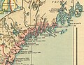
 Acadia National Park and vicinity, Hancock Co., Maine. 1971. LOC 78692599.jpg 7,972 × 8,663; 11.31 MB
-
 Main 1660.jpg 1,943 × 1,498; 950 KB
-
 Rand McNally Map of Maine.jpg 2,685 × 3,619; 2.91 MB


