Category:20th-century maps of Montana
States of the United States: Alabama · Alaska · Arizona · Arkansas · California · Colorado · Connecticut · Delaware · Florida · Georgia · Hawaii · Idaho · Illinois · Indiana · Iowa · Kansas · Kentucky · Louisiana · Maine · Maryland · Massachusetts · Michigan · Minnesota · Mississippi · Missouri · Montana · Nebraska · Nevada · New Hampshire · New Jersey · New Mexico · New York · North Carolina · North Dakota · Ohio · Oklahoma · Oregon · Pennsylvania · Rhode Island · South Carolina · South Dakota · Tennessee · Texas · Utah · Vermont · Virginia · Washington · West Virginia · Wisconsin · Wyoming – Washington, D.C.
Puerto Rico
Puerto Rico
Subcategories
This category has the following 5 subcategories, out of 5 total.
2
Media in category "20th-century maps of Montana"
The following 23 files are in this category, out of 23 total.
-
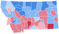
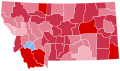
 Montana 1992 presidential results by county.png 3,411 × 1,910; 2.27 MB
-
 Montana Presidential Election Results 1920.svg 317 × 184; 26 KB
-
 Montana Presidential Election Results 1924.svg 810 × 473; 48 KB
-
 Montana Presidential Election Results 1928.svg 810 × 473; 48 KB
-
 Montana Presidential Election Results 1932.svg 810 × 473; 48 KB
-
 Montana Presidential Election Results 1936.svg 810 × 473; 48 KB
-
 Montana Presidential Election Results 1940.svg 810 × 473; 48 KB
-
 Montana Presidential Election Results 1944.svg 810 × 473; 48 KB
-
 Montana Presidential Election Results 1948.svg 810 × 473; 48 KB
-
 Montana Presidential Election Results 1952.svg 810 × 473; 47 KB
-
 Montana Presidential Election Results 1956.svg 810 × 473; 47 KB
-
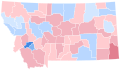
 Montana Presidential Election Results 1960.svg 744 × 442; 486 KB
-
 Montana Presidential Election Results 1964.svg 744 × 442; 486 KB
-
 Montana Presidential Election Results 1968.svg 744 × 442; 486 KB
-
 Montana Presidential Election Results 1972.svg 744 × 442; 486 KB
-
 Montana Presidential Election Results 1980.svg 810 × 473; 47 KB
-
 Montana Presidential Election Results 1984.svg 810 × 473; 47 KB
-
 Montana Presidential Election Results 1988.svg 810 × 473; 47 KB
-
 Montana Presidential Election Results 1992.svg 810 × 473; 47 KB
-
 Montana Presidential Election Results 1996.svg 810 × 473; 48 KB
-
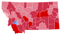
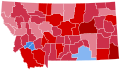
 Montana Presidential Election Results 2000.svg 810 × 473; 48 KB
-
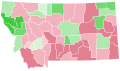
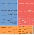 Tree map of Montana 1992 Presidential election by county.png 3,859 × 3,968; 1.11 MB
-
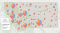
 Western Canada, Washington, Montana, and Washington 1925 Air Routes.jpg 596 × 1,410; 211 KB


