Category:Aerial photographs of Alberta
Provinces and territories of Canada: Alberta · British Columbia · Manitoba · New Brunswick · Newfoundland and Labrador · Nova Scotia · Ontario · Prince Edward Island · Quebec · Saskatchewan · Northwest Territories · Nunavut · Yukon
Subcategories
This category has the following 10 subcategories, out of 10 total.
A
Media in category "Aerial photographs of Alberta"
The following 151 files are in this category, out of 151 total.
-
 2013-07-11-canada-edmunton-spruce-grove-corn-maze.jpg 5,023 × 3,352; 3.84 MB
-
 2018-10-21 Canada (1).jpg 4,000 × 3,000; 2.28 MB
-
 2018-10-21 Canada (2).jpg 4,000 × 3,000; 2.31 MB
-
 29 Flight BATUS AAC.jpg 904 × 892; 369 KB
-
 4P5C8423 (14252150531).jpg 3,518 × 3,527; 6.66 MB
-
 A beautiful day to blast around the "Rocks" (8350033921).jpg 3,264 × 2,448; 2.47 MB
-
 AC 319 Flight (YYZ to YEG) (6803811640).jpg 1,441 × 1,441; 908 KB
-
 Aerial - Alberta, 30 km east of Pakowki Lake 01 (10452831016).jpg 4,288 × 2,848; 5.02 MB
-
 Aerial - Alberta, 30 km east of Pakowki Lake 01 - white balanced (10453047703).jpg 4,288 × 2,848; 10.68 MB
-
 Aerial - Alberta, 30 km east of Pakowki Lake 02 (10452947825).jpg 2,848 × 4,288; 5.2 MB
-
 Aerial - Alberta, 30 km east of Pakowki Lake 02 - white balanced (10452963544).jpg 2,848 × 4,288; 8.41 MB
-
 Aerial - Alberta, 30 km east of Pakowki Lake 03 (10453006805).jpg 4,288 × 2,848; 5.05 MB
-
 Aerial - Alberta, 30 km east of Pakowki Lake 03 - white balanced (10453035336).jpg 4,288 × 2,848; 8.95 MB
-
 Aerial - Alberta, east of Pakowki Lake 01 (10452719125).jpg 4,288 × 2,848; 4.56 MB
-
 Aerial - Alberta, east of Pakowki Lake 01 - white balanced (10452754886).jpg 4,288 × 2,848; 10.4 MB
-
 Aerial - Coutts, Alberta & Sweet Grass, MT 01 (10321153895).jpg 4,288 × 2,848; 5.05 MB
-
 Aerial - Coutts, Alberta & Sweet Grass, MT 01 - white balanced (10321201586).jpg 4,288 × 2,848; 7.09 MB
-
 Aerial - Milk River and Pakowki Lake 01 (10433106584).jpg 4,288 × 2,848; 4.94 MB
-
 Aerial - Milk River and Pakowki Lake 01 - white balanced (10433148834).jpg 4,288 × 2,848; 8.94 MB
-
 Aerial - Milk River and Pakowki Lake 02 (10433185956).jpg 4,288 × 2,848; 4.77 MB
-
 Aerial - Milk River and Pakowki Lake 02 - white balanced (10433378333).jpg 4,288 × 2,848; 8.68 MB
-
 Aerial - Milk River and Pakowki Lake 03 (10433402473).jpg 4,288 × 2,848; 4.98 MB
-
 Aerial - Milk River and Pakowki Lake 03 - white balanced (10433296346).jpg 4,288 × 2,848; 9.04 MB
-
 Aerial - Milk River south of Pakowki Lake 01 (10432817483).jpg 4,288 × 2,848; 4.65 MB
-
 Aerial - Milk River south of Pakowki Lake 01 - white balanced (10432739585).jpg 4,288 × 2,848; 10.32 MB
-
 Aerial - Milk River, Alberta 01 (10413485976).jpg 4,288 × 2,848; 4.86 MB
-
 Aerial - Milk River, Alberta 01 - white balanced (10414057523).jpg 4,288 × 2,848; 8.47 MB
-
 Aerial - Milk River, Alberta 02 (10413515585).jpg 4,288 × 2,848; 4.64 MB
-
 Aerial - Milk River, Alberta 02 - white balanced (10413937414).jpg 4,288 × 2,848; 8.51 MB
-
 Aerial - near Coutts, Alberta & Sweet Grass, MT 01 (10322406125).jpg 4,288 × 2,848; 3.93 MB
-
 Aerial - near Coutts, Alberta & Sweet Grass, MT 01 - white balanced (10321224294).jpg 4,288 × 2,848; 7.04 MB
-
 Aerial - north end of Alberta Highway 880 - 01 (10413479613) (2).jpg 4,288 × 2,848; 4.49 MB
-
 Aerial - north end of Alberta Highway 880 - 01 - white balanced (10413639115).jpg 4,288 × 2,848; 10.6 MB
-
 Aerial - Pakowki Lake 01 (10432813184).jpg 4,288 × 2,848; 4.66 MB
-
 Aerial - Pakowki Lake 01 - white balanced (10433028693).jpg 4,288 × 2,848; 9.65 MB
-
 Aerial - Pakowki Lake 02 (10432989415).jpg 4,288 × 2,848; 4.59 MB
-
 Aerial - Pakowki Lake 02 - white balanced (10433018266).jpg 4,288 × 2,848; 9.13 MB
-
 Aerial - Pakowki Lake 03 (10433191943).jpg 4,288 × 2,848; 4.67 MB
-
 Aerial - Pakowki Lake 03 - white balanced (10433112115).jpg 4,288 × 2,848; 9.86 MB
-
 Aerial - Pakowki Lake and north 01 (10432753166).jpg 2,848 × 4,288; 4.79 MB
-
 Aerial - Pakowki Lake and north 01 - white balanced (10432949403).jpg 2,848 × 4,288; 8.94 MB
-
 Aerial - Pakowki Lake and north 02 (10433055353).jpg 2,848 × 4,288; 4.61 MB
-
 Aerial - Pakowki Lake and north 02 - white balanced (10432964085).jpg 2,848 × 4,288; 8.13 MB
-
 Aerial - Pakowki Lake and west, Alberta 01 (10413363315) (2).jpg 4,288 × 2,848; 4.99 MB
-
 Aerial - Pakowki Lake and west, Alberta 01 - white balanced (10413665184) (2).jpg 4,288 × 2,848; 9.26 MB
-
 Aerial - Pakowki Lake and west, Alberta 02 (10413538106).jpg 2,848 × 4,288; 4.94 MB
-
 Aerial - Pakowki Lake and west, Alberta 02 - white balanced (10413582655).jpg 2,848 × 4,288; 7.13 MB
-
 Aerial - Pakowki Lake, Alberta from the southeast 01 (10452941573).jpg 4,288 × 2,848; 4.47 MB
-
 Aerial - Pakowki Lake, Alberta from the southeast 01 - white balanced (10453089823).jpg 4,288 × 2,848; 9.39 MB
-
 Aerial - Verdigris Lake, Alberta from SE 01 (10413605643).jpg 4,288 × 2,848; 4.53 MB
-
 Aerial - Verdigris Lake, Alberta from SE 01 - white balanced (10413842774).jpg 4,288 × 2,848; 7.72 MB
-
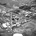
 Aerial photograph of Lethbridge, Alberta, in 1912.jpg 370 × 216; 126 KB
-

-
 Aerial view of Alberta northeast of Coutts 01 (10413580933).jpg 4,288 × 2,848; 4.67 MB
-
 Aerial view of Alberta northeast of Coutts 01 - white balanced (10413825205).jpg 4,288 × 2,848; 8.25 MB
-
 Aerial view of Alberta northeast of Coutts 02 (10413392794).jpg 4,288 × 2,848; 4.69 MB
-
 Aerial view of Alberta northeast of Coutts 02 - white balanced (10413779265).jpg 4,288 × 2,848; 8.33 MB
-
 Aerial view of Alberta northeast of Coutts 03 (10413387455).jpg 4,288 × 2,848; 4.58 MB
-
 Aerial view of Alberta northeast of Coutts 03 - white balanced (10413877483).jpg 4,288 × 2,848; 8.62 MB
-

-
 Air View Of Chipewyan Lake, Alberta (6635622585).jpg 632 × 518; 76 KB
-
 Airdrie Airport Alberta Canada.jpg 2,460 × 2,829; 4.72 MB
-
 Airdrie Towards Mountains Aerial (48796460641).jpg 3,600 × 2,400; 3.8 MB
-
 Airdrie-aerial.JPG 2,169 × 840; 1.81 MB
-
 Alberta (4962810132).jpg 1,871 × 1,243; 249 KB
-
 Alberta oil field.JPG 2,592 × 1,944; 3.34 MB
-
 Alberta, Canada, spring, 23 April 2011 - Flickr - PhillipC (1).jpg 4,288 × 2,848; 4.63 MB
-
 Alberta, Canada, spring, 23 April 2011 - Flickr - PhillipC.jpg 4,288 × 2,848; 3.94 MB
-
 Athabasca oil sands.jpg 720 × 480; 175 KB
-
 Athabasca University (J).jpg 3,952 × 3,032; 7.47 MB
-
 Banff National Park (16462735703).jpg 1,200 × 1,600; 2.15 MB
-
 Barrier Lake Kananaskis Aerial.jpg 2,272 × 1,704; 1.4 MB
-
 Bearspaw, Alberta.JPG 2,592 × 1,944; 3.86 MB
-
 Beaumont from an Airplane, Alberta.jpg 1,300 × 885; 542 KB
-
 Brooksfromthesky.jpg 3,872 × 2,592; 3.62 MB
-
 Buck Lake from Airplane.jpg 3,456 × 4,608; 2.99 MB
-
 Canada - Alberta, Banff City - panoramio.jpg 5,184 × 2,920; 4.56 MB
-
 Canada - Jasper - NARA - 68154624.jpg 6,778 × 5,298; 17.02 MB
-
 Canada - Jasper through Henry House Station - NARA - 68154612 (cropped).jpg 5,396 × 4,345; 11.97 MB
-
 Canada - Jasper through Henry House Station - NARA - 68154612.jpg 6,778 × 5,298; 17.08 MB
-
 Canmore from 8500 (8587575341).jpg 2,448 × 3,264; 3.3 MB
-
 Central Alberta.JPG 4,912 × 3,264; 5.8 MB
-
 CF-104 Starfighters of 417 Sqn in flight near Cold Lake 1976.jpg 1,280 × 802; 946 KB
-
 Cochrane Alberta (8625233134).jpg 5,184 × 3,456; 2.29 MB
-
 Cochrane, Alberta (3460510301).jpg 2,856 × 4,290; 2.37 MB
-
 Cold Lake, Canada.jpg 1,573 × 955; 1.83 MB
-
 Conoco Phillips 2016 (25411424220).jpg 2,510 × 2,048; 4.26 MB
-
 CORNER OF THIRD AVE AND FIFTH ST LETHBEIDGE ALBERTA (35345558271).jpg 1,740 × 1,100; 1.48 MB
-
 Costa Rica - Puntarenas - NARA - 68154684.jpg 6,778 × 5,298; 15.97 MB
-
 Division No. 18, AB, Canada - panoramio (1).jpg 3,008 × 2,000; 1.29 MB
-
 Division No. 18, AB, Canada - panoramio (2).jpg 3,008 × 2,000; 1.42 MB
-
 Division No. 18, AB, Canada - panoramio.jpg 3,008 × 2,000; 1.53 MB
-
 F-4N Phantoms of VF-201 in flight with 417 Sqn CF-104s in 1976.jpg 1,968 × 1,488; 1.92 MB
-
 Fairview, Alberta (July 2016).jpg 3,372 × 2,248; 6.49 MB
-
 Flying over a branch of the Saskatchewan River in Alberta.jpg 3,264 × 2,448; 3.5 MB
-
 Foothills southwest of Calgary (3837706019).jpg 4,290 × 2,856; 1.67 MB
-
 Fort Chipewyan aerial.jpg 480 × 360; 53 KB
-
 Fort Saskatchewan 1980.jpg 3,053 × 2,400; 8.02 MB
-
 FortMacKay.jpg 3,648 × 2,736; 2.91 MB
-
 FortVermilion-Aerial.JPG 1,600 × 1,200; 856 KB
-
 Frozen Lake (537214192).jpg 1,280 × 960; 77 KB
-
 Ghost Lake-aerial01.Alberta.CA.jpg 482 × 187; 58 KB
-
 Grande Prairie-aerial.JPG 2,568 × 984; 2.14 MB
-
 In flight (5447765258).jpg 1,936 × 2,592; 2.95 MB
-
 In flight (5447770726).jpg 2,592 × 1,936; 1.73 MB
-
 Kananaskis aerial.jpg 1,597 × 571; 961 KB
-
 Kearl lake.jpg 4,288 × 3,216; 1.86 MB
-
 Kelsey air.jpg 408 × 266; 20 KB
-
 Lac Brûlé (Alberta).jpg 845 × 730; 274 KB
-
 Lake Athabasca, Canada.jpg 1,156 × 488; 173 KB
-
 Langdon, Alberta.JPG 1,900 × 1,465; 2.28 MB
-
 Light Fog and Snow Aerial - Outside Edmonton (29078193531).jpg 2,400 × 1,600; 1.74 MB
-
 Limestone pit (5743305973).jpg 4,288 × 3,216; 1.57 MB
-
 Limestone pit (5743857546).jpg 4,288 × 3,216; 1.55 MB
-
 Lloydminster City Hall.jpg 3,124 × 2,343; 1.12 MB
-
 May 2011 Wildfires in Alberta, Canada.jpg 5,560 × 4,448; 5.26 MB
-
 Medicine River Alberta aerial.jpg 2,883 × 2,230; 1.93 MB
-
 Millet, AB (4705080899).jpg 1,600 × 1,200; 295 KB
-
 Mirror-lake-in-Camrose-Alberta.jpg 1,200 × 630; 106 KB
-
 Moutains around Banff, with Spray River.jpg 3,985 × 2,845; 3.38 MB
-
 N saskatchewan river.jpg 639 × 637; 209 KB
-
 Nakiska ski hills Alberta (8625233430).jpg 5,184 × 3,456; 2.22 MB
-
 Nisku, AB (4706062919).jpg 1,600 × 995; 266 KB
-
 North Saskatchewan River Foggy Aerial (28534086854).jpg 2,400 × 1,600; 1.03 MB
-
 North-Am International Ski-Doo Race, Wetaskiwin, Alberta (25140086479).jpg 3,000 × 2,430; 2.72 MB
-
 Northern Alberta Forests Aerial (28534083144).jpg 2,400 × 1,600; 2.67 MB
-
 Peace River aerial.jpg 3,457 × 1,891; 551 KB
-
 Potato Harvest Rolling Hills Alberta.jpg 4,000 × 2,250; 4.03 MB
-
 Potato harvest Rolling Hills Alberta.jpg 4,000 × 2,250; 3.87 MB
-
 Prairie town (1526806913).jpg 2,272 × 1,704; 1.99 MB
-
 Quarry of the Ancestors Sep 2009 186 (5643945514).jpg 4,000 × 3,000; 2.72 MB
-
 RichardsonBackcountry.JPG 3,648 × 2,736; 2.3 MB
-
 Rosebud River Valley (4705723538).jpg 1,200 × 1,600; 160 KB
-
 Smoky River east of GP.JPG 1,872 × 2,380; 3.19 MB
-
 South Saskatchewan near Medicine Hat.jpg 3,872 × 2,592; 2.63 MB
-
 Southern Alberta (4581781970).jpg 4,272 × 2,848; 1.73 MB
-
 St. Albert Grain Elevator.JPG 6,000 × 4,000; 8.69 MB
-
 Sulfur pyramid -8650842382 db6080560b o.jpg 4,288 × 3,216; 7.81 MB
-
 Sunrays (18437116378).jpg 2,500 × 1,875; 949 KB
-
 Sunrays (18437178960).jpg 2,500 × 1,875; 960 KB
-
 Syncrude mildred lake plant.jpg 1,024 × 768; 136 KB
-
 Syncrude oil sands mine works, Mildred Lake, Alberta.jpg 2,088 × 1,563; 729 KB
-
 SyncrudeWoodBuffalo.JPG 3,648 × 2,736; 2.31 MB
-
 Tar sands in alberta 2008.jpg 800 × 600; 626 KB
-
 The Bow Valley (3838466732).jpg 4,290 × 2,856; 4.11 MB
-
 The Columbia Icefield (5406982498).jpg 4,272 × 2,848; 1.85 MB
-
 The North Saskatchewan River (3554780937).jpg 2,856 × 4,290; 5.76 MB
-
 Tipi from the air (2602066936).jpg 3,872 × 2,592; 2.77 MB
-
 Waterways Fort McMurray September 21 2016 (29752012552).jpg 5,184 × 3,456; 8.09 MB
-
 Wetaskiwin, AB (4705723490).jpg 1,600 × 1,200; 385 KB
-
 Winglet Shot Over Southern Alberta (4581782742).jpg 2,848 × 4,272; 1.17 MB

.jpg)
.jpg)

.jpg)
.jpg)
_(6803811640).jpg)
.jpg)
.jpg)
.jpg)
.jpg)
.jpg)
.jpg)
.jpg)
.jpg)
.jpg)
.jpg)
.jpg)
.jpg)
.jpg)
.jpg)
.jpg)
.jpg)
.jpg)
.jpg)
.jpg)
.jpg)
.jpg)
.jpg)
.jpg)
.jpg)
_(2).jpg)
.jpg)
.jpg)
.jpg)
.jpg)
.jpg)
.jpg)
.jpg)
.jpg)
.jpg)
.jpg)
.jpg)
_(2).jpg)
_(2).jpg)
.jpg)
.jpg)
.jpg)
.jpg)
.jpg)
.jpg)


.jpg)
.jpg)
.jpg)
.jpg)
.jpg)
.jpg)

.jpg)

.jpg)
.jpg)

.jpg)


.jpg)
.jpg)


.jpg)

.jpg)


.jpg)
.jpg)

.jpg)
.jpg)

.jpg)
.jpg)


.jpg)

.jpg)


.jpg)
.jpg)
.jpg)


.jpg)


.jpg)
.jpg)
.jpg)


.jpg)


.jpg)
.jpg)
.jpg)
.jpg)
.jpg)


.jpg)
.jpg)

.jpg)


.jpg)


.jpg)
.jpg)


.jpg)
.jpg)
.jpg)
.jpg)
.jpg)
.jpg)
.jpg)