Category:Aerial photographs of Ontario
Provinces and territories of Canada: Alberta · British Columbia · Manitoba · New Brunswick · Newfoundland and Labrador · Nova Scotia · Ontario · Prince Edward Island · Quebec · Saskatchewan · Northwest Territories · Nunavut · Yukon
Subcategories
This category has the following 11 subcategories, out of 11 total.
A
N
W
Media in category "Aerial photographs of Ontario"
The following 140 files are in this category, out of 140 total.
-
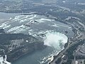
 Niagara Falls from the International Space Station 2013-03-15.jpg 1,024 × 679; 116 KB
-
 416 into Ottawa.png 800 × 600; 694 KB
-
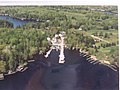
 Aerial - Holland River valley south of Cooks Bay 01 (9659638510).jpg 4,288 × 2,848; 4.5 MB
-
 Aerial - Holland River valley south of Cooks Bay 01 - white balanced (9659666890).jpg 4,288 × 2,848; 8.88 MB
-
 Aerial of Caland Mine Site.jpg 5,460 × 4,290; 4.86 MB
-
 Aerial of Marathon - panoramio.jpg 1,800 × 1,195; 1.24 MB
-
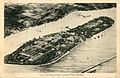
 Aerial photo of Nicholson, Ontario, 1931.jpg 1,400 × 945; 187 KB
-
 Aerial photograph (of Scarborough Bluffs?). (24235785051).jpg 1,365 × 1,060; 1.4 MB
-
 Aerial photography in Air Canada B777-300ER - panoramio.jpg 3,264 × 4,912; 2.82 MB
-
 Aerial shot of Wintery Farmland (3242748835).jpg 3,872 × 2,592; 4.1 MB
-
 Aerial shot of Wintery Farmland (3243624528).jpg 3,872 × 2,592; 2 MB
-
 Aerial view of a river near Parry Sound -a.jpg 3,008 × 2,000; 2.58 MB
-
 Aerial view of a river near Parry Sound -b.jpg 2,000 × 3,008; 2.88 MB
-
 Aerial view of Buffalo in 2010.jpg 3,504 × 2,336; 2.89 MB
-
 Aerial view of Clearydale Farms near Spencerville, Ontario.jpg 1,024 × 743; 183 KB
-
 Aerial view of Kettle Point -a.jpg 4,368 × 2,912; 10.77 MB
-
 Aerial view of Kettle Point -b.jpg 4,024 × 2,222; 8.77 MB
-
 Aerial view of Kettle Point -c.jpg 3,864 × 2,350; 8.05 MB
-
 Aerial view of Kettle Point -d.jpg 3,654 × 1,976; 7.06 MB
-
 Aerial view of Kettle Point -e.jpg 4,368 × 2,912; 11.69 MB
-
 Aerial view of Schreiber from the 1890s.jpg 1,600 × 1,073; 460 KB
-
 Aerial view of the Notre Dame Hospital.jpg 720 × 378; 97 KB
-
 Aerial view of the St. Clair River and Lake St. Clair.jpg 3,024 × 4,032; 2.26 MB
-
-
 Aerial view of Victoria Hospital circa 1930.png 1,194 × 709; 1.11 MB
-
 Aerial view of Victoria Hospital circa 1945.png 949 × 757; 1.05 MB
-
 Aerial View Red Lake 1936.jpg 1,280 × 853; 1.15 MB
-
 AerialArmstrong.jpg 4,032 × 3,024; 2.62 MB
-
 AerialPhotoColborne1.jpg 400 × 300; 31 KB
-
 Albany River.JPG 1,870 × 2,338; 1.03 MB
-
 Amherst Island, Stella Village.jpg 4,900 × 3,673; 3.77 MB
-
 Areal Track Photo.jpg 4,032 × 3,024; 5.42 MB
-
 Attawapiskat Town between Attawapiskat River.jpg 640 × 480; 28 KB
-
 Bare Oaks Aerial.jpg 1,024 × 768; 367 KB
-
 Bayfield River enters Lake Huron.jpg 1,111 × 1,555; 1.66 MB
-
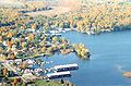
 Beaumaris from the air.JPG 2,560 × 1,920; 1.9 MB
-
 Blackbinder 1236.jpg 922 × 600; 127 KB
-
 Blenheim, Ontario (32540493677).jpg 5,184 × 3,888; 18.25 MB
-
 Blenheim, Ontario (33605844998).jpg 5,184 × 3,888; 17.31 MB
-
 Boreal Forest Ring.jpg 1,760 × 1,200; 329 KB
-
 Bruce Mines ON 2.JPG 2,000 × 1,333; 908 KB
-
 Canada - Ontario, Toronto - panoramio.jpg 4,896 × 2,752; 5.08 MB
-
 Caribouisland.jpg 1,024 × 768; 179 KB
-
 Carleton Place from the air.jpg 3,888 × 2,592; 11.24 MB
-
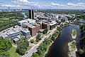 CarletonUniversity2022.jpg 5,430 × 3,617; 4.09 MB
-
 Champ Ontario par avion.jpg 3,648 × 2,736; 3.86 MB
-
 Charleson Recretion Area.jpg 276 × 183; 6 KB
-
 City lights (October 2009).jpg 3,648 × 2,736; 3.02 MB
-
 Coast of Southern Ontario (51156477747).jpg 2,400 × 3,600; 4.19 MB
-
 Coboconk.jpg 640 × 256; 47 KB
-
 Cockburn Island 1.JPG 1,600 × 960; 249 KB
-
 Detroit River Draining Into Lake Erie, Michigan (21691142062).jpg 4,000 × 3,000; 2.85 MB
-
 Dorset, Lake of Bays - On Grand Trunk Railway System..jpg 659 × 423; 133 KB
-

-
 Embro ON.JPG 2,048 × 1,365; 1.29 MB
-
 Erie Beach baseball stadium (I0010120).jpg 4,122 × 3,116; 4 MB
-
 Essex County, Ontario (21514674370).jpg 4,000 × 3,000; 2.11 MB
-
 Essex County, Ontario (21514760668).jpg 4,000 × 3,000; 2.21 MB
-
 Fallairphoto.jpg 768 × 799; 142 KB
-
 Fighting Island, LaSalle, Ontario (21079792884).jpg 3,720 × 2,790; 5.3 MB
-
 Fort Erie, Ontario (46567222185).jpg 5,184 × 3,888; 4.65 MB
-
 Fort Erie, Ontario and Unity Island, New York (40516470353).jpg 5,184 × 3,888; 4.69 MB
-

-
 Garden City Skyway, September 1963.png 1,574 × 2,011; 3.13 MB
-
 Grand Island, New York (47482499371).jpg 5,184 × 3,888; 11.7 MB
-
 Grey Highlands Secondary School 2021.jpg 4,000 × 2,250; 3.25 MB
-
 Hastings County Archives 2017-61 (6) front (34935922394).jpg 2,144 × 1,381; 361 KB
-
 Hastings County Archives 2017-91-06 (37070933734).jpg 1,968 × 1,369; 1.51 MB
-
 Helicopter view of Kenora, Ontario, Canada..jpg 2,137 × 1,202; 1.94 MB
-
 High Falls, Ontario, Canada; Aerial view (I0015353).jpg 2,488 × 1,971; 3.52 MB
-
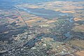
 Holland Marsh over Bradford.png 2,646 × 1,906; 8.66 MB
-
 Humber College North Campus From The Air - 1.jpg 2,448 × 3,264; 2.03 MB
-
 I can see for miles - panoramio.jpg 470 × 321; 122 KB
-
 Kenora, Ontario, Canada; Aerial view (I0015581).jpg 2,491 × 1,981; 3.84 MB
-
 Kenora, Ontario, Canada; Aerial view (I0015582).jpg 2,492 × 1,978; 3.95 MB
-
 Kettle Point on Lake Huron.jpg 3,504 × 2,336; 8.47 MB
-
 Killaloe-Bonnechere Airport Aerial 2007.jpg 3,072 × 2,304; 3.62 MB
-
 Lake Erie Islands, Lake Erie in Ohio and Ontario, Canada (7992985986).jpg 4,000 × 3,000; 1.65 MB
-
 Lake Erie North Short photo D Ramey Logan.jpg 3,648 × 2,736; 6.42 MB
-
 Lake Huron and Lake Erie Both in View, Southwestern Ontario, Canada (32540492767).jpg 5,184 × 3,888; 3.39 MB
-
 Lake Huron and Lake Erie Both in View, Southwestern Ontario, Canada (32540492907).jpg 5,184 × 3,888; 3.37 MB
-
 Lake Huron and Lake Erie Both in View, Southwestern Ontario, Canada (33605844858).jpg 5,184 × 3,888; 3.33 MB
-
 Lake Huron and Lake Erie Both in View, Southwestern Ontario, Canada (33605846298).jpg 5,184 × 3,888; 3.37 MB
-
 Lake Huron and Lake Erie Both in View, Southwestern Ontario, Canada (33605846388).jpg 5,184 × 3,888; 3.3 MB
-
 Lake of Bays Frozen Aerial View.jpg 3,024 × 4,032; 2.15 MB
-
 Lake Saint Clair and Shores Aerial (51157379658).jpg 3,600 × 2,400; 3.93 MB
-
 Lake St. Clair and Chatham, Ontario (33605847278).jpg 5,184 × 3,888; 15.89 MB
-
 Landscapes of Canada in Winter - panoramio.jpg 5,184 × 3,456; 7.21 MB
-
 Lighthouse Cove - Lakeshore Ontario (51157143791).jpg 3,600 × 2,400; 4.09 MB
-
 Looking north on Pelee Island -a.jpg 1,704 × 2,272; 400 KB
-
 Moosonee Christ The King.jpg 593 × 432; 145 KB
-
 Moosonee downtown aerial.jpg 3,168 × 2,112; 1.64 MB
-
 Niagara Falls Horseshoe Falls 02.jpg 4,032 × 3,024; 4.31 MB
-
 Niagara Falls Horseshoe Falls 03.jpg 4,032 × 3,024; 4.27 MB
-
 Niagara Falls Whirlpool aerial view.jpg 4,916 × 3,215; 5.99 MB
-
 Niagara River Between Ontario and New York (47482503071).jpg 5,184 × 3,888; 4.65 MB
-
 Northeastern Ontario Banner.jpg 3,168 × 453; 620 KB
-
 Oastler Lake.jpg 1,280 × 853; 111 KB
-
 Ogoki River.JPG 1,944 × 2,431; 1.29 MB
-
 Ojibwa Ont Canadian Steel Corp.jpg 5,427 × 3,761; 5.17 MB
-
 Ontario Farmland (18632603183).jpg 1,920 × 1,080; 133 KB
-
 Ontario Marshmallow Farm (63885158).jpg 1,800 × 1,198; 1.46 MB
-
 Ontario New York border aerial.jpg 1,064 × 1,512; 313 KB
-
 OPG Caribou Falls GS.jpg 640 × 447; 126 KB
-
 Parc provincial Presqu'ile - Q400.jpg 3,200 × 2,368; 1.44 MB
-
 Parry Island.JPG 1,555 × 1,920; 877 KB
-
 Passing by Muskoka (2451330553).jpg 2,272 × 1,704; 3.29 MB
-
 Pie Island 2.jpg 1,800 × 1,200; 673 KB
-
 Pinery Provincial Park, on the shore of Lake Huron.jpg 3,192 × 976; 4.78 MB
-
 Point Pelee National Park, Ontario, Canada (7238172160).jpg 3,000 × 4,000; 6.34 MB
-
 Portlandairbymarcosmits.jpg 300 × 197; 16 KB
-
 Power station on the Niagara River (27896070345).jpg 4,928 × 3,264; 3.92 MB
-
 Prince wind farm.jpg 604 × 453; 54 KB
-
 RCAF Dunnville Aerial View 1940s.jpg 1,024 × 922; 154 KB
-
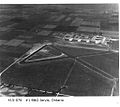 RCAF Jarvis Aerial View 1940s.jpg 1,024 × 913; 114 KB
-
 Rondeau Provincial Park Aerial (51157379813).jpg 3,600 × 2,400; 3.9 MB
-
 Sault St Marie (4559945434).jpg 4,290 × 2,856; 9.39 MB
-
 Silver Islet ON.JPG 2,000 × 1,333; 818 KB
-
 Sioux Lookout ON 2.JPG 1,600 × 1,066; 237 KB
-
 Sleeping Giant PP.JPG 1,536 × 2,048; 841 KB
-
 Source of the Detroit River at Lake St. Clair, Detroit Michigan (21514444320).jpg 3,540 × 2,660; 5.03 MB
-
 South Coast of Ontario, Canada from Lake Erie (47429663692).jpg 5,184 × 3,888; 3.17 MB
-
 Southern Ontario at night.png 954 × 608; 876 KB
-
 Southern Ontario Coast from Lake Erie (32540490927).jpg 5,184 × 3,888; 3.36 MB
-
 Southwestern Ontario, Canada (21514574430).jpg 4,000 × 3,000; 3.22 MB
-
 Southwestern Ontario, Canada (33605846898).jpg 5,184 × 3,888; 17.14 MB
-
 Spencer Smith Park Compass Aerial Shot (21413821782).jpg 4,384 × 2,466; 7.75 MB
-
 Thames Centre ON.JPG 1,800 × 1,500; 1.01 MB
-
 Thames River, Ontario, Canada (32540493747).jpg 5,184 × 3,888; 16.76 MB
-
 The border control post on the US side (27861084136).jpg 4,928 × 3,264; 3.93 MB
-
 The bridge linking Canada with the USA (27283744924).jpg 4,928 × 3,264; 3.93 MB
-
 The Detroit River Between Detroit, Michigan and Windsor, Ontario (21515641179).jpg 3,000 × 4,000; 2.66 MB
-
 The Detroit River Between Detroit, Michigan and Windsor, Ontario (21702477435).jpg 3,000 × 4,000; 2.46 MB
-
 Thornton-1.jpg 3,888 × 2,400; 10.13 MB
-
 Trinity Anglican Church Cornwall.jpg 300 × 300; 28 KB
-
 View of Stoney Creek from the mountain (I0004161).jpg 3,900 × 2,719; 4.72 MB
-
 View out of De Havilland Canada Dash 8 flying over ontario.jpg 4,032 × 3,024; 2.11 MB
-
 Vineyards and the road we came on (27861133686).jpg 4,928 × 3,264; 4.42 MB
-
 We are almost over the falls now (27283603973).jpg 4,928 × 3,264; 4.09 MB
-
 Zhiibaahaasing 19A.jpg 1,800 × 1,200; 968 KB


.jpg)
.jpg)


._(24235785051).jpg)

.jpg)
.jpg)


.jpg)
.jpg)


.jpg)
.jpg)

.jpg)

.jpg)

.jpg)
.jpg)
.jpg)

.jpg)
.jpg)
.jpg)


.jpg)

_front_(34935922394).jpg)
.jpg)

.jpg)


.jpg)
.jpg)


.jpg)

.jpg)
.jpg)
.jpg)
.jpg)
.jpg)

.jpg)
.jpg)

.jpg)


.jpg)


.jpg)
.jpg)


.jpg)

.jpg)

.jpg)


.jpg)
.jpg)


.jpg)
.jpg)

.jpg)
.jpg)
.jpg)
.jpg)

.jpg)
.jpg)
.jpg)
.jpg)
.jpg)


.jpg)

.jpg)
.jpg)
